


Grenoble is surrounded by three mountain ranges: Chartreuse, Vercors and Belledonnes. During this trip we climbed the most characteristic rock of Chartreuse - the Mont St-Eynard.
The ascent starts in La Tronche and in Corenc it gets immediately serious. Up till the Col de Vence you can expect demanding, almost 10% steep climb. You can rest a bit (still climbing) after passing the saddle, but just until you leave the busy road before le Sappey-en-Chartreuse. In le Gouillat turn south and face the most steep part of the trip. Climb till the fort on the top of the moutain. The asfalt road you follow is of good quality till the very end.
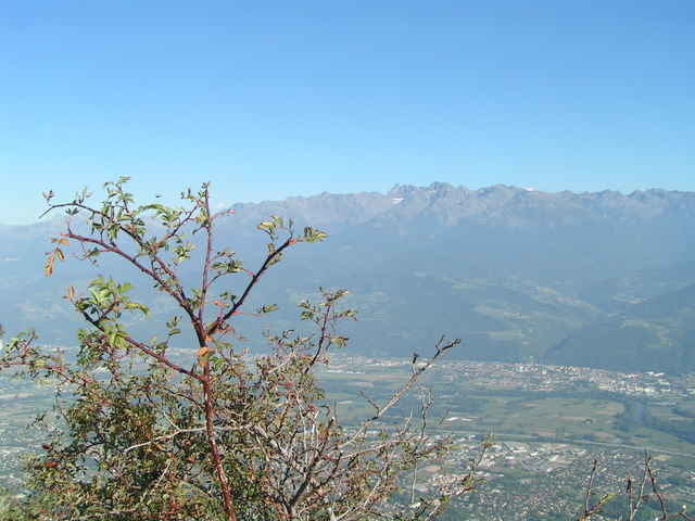
The reward for the effort is remarkable. From the fort you can expect beautiful views of the Isere valley and Belledonnes on the other side. You usually can see the Grenoble agglomeration expanding over 1000 meters below and the snow covering the remote peaks.
It is definitely worth to climb to the fort three times. For the first time do it during the day with clear weather to enjoy the height and feel the distances. Then climb it when the clouds cover the valley and you can get above them to see the mountains overlooking the ocean of clouds.
Finally don't miss the night view to see the lights of the agglomeration.
You can descend to the city following the same route in the opposite direction.
The ascent starts in La Tronche and in Corenc it gets immediately serious. Up till the Col de Vence you can expect demanding, almost 10% steep climb. You can rest a bit (still climbing) after passing the saddle, but just until you leave the busy road before le Sappey-en-Chartreuse. In le Gouillat turn south and face the most steep part of the trip. Climb till the fort on the top of the moutain. The asfalt road you follow is of good quality till the very end.
The reward for the effort is remarkable. From the fort you can expect beautiful views of the Isere valley and Belledonnes on the other side. You usually can see the Grenoble agglomeration expanding over 1000 meters below and the snow covering the remote peaks.
It is definitely worth to climb to the fort three times. For the first time do it during the day with clear weather to enjoy the height and feel the distances. Then climb it when the clouds cover the valley and you can get above them to see the mountains overlooking the ocean of clouds.
Finally don't miss the night view to see the lights of the agglomeration.
You can descend to the city following the same route in the opposite direction.
Tour Galerie
Tour Karte und Höhenprofil
Minimale Höhe 192 m
Maximale Höhe 1328 m
Mehr zum Tourautor

|
azzie |
Kommentare

In fact you can start anywhere in Greoble ;-) As mentioned earlier, the climb starts in La Tronche.
GPS-Tracks
Trackpunkte-
GPX / Garmin Map Source (gpx) download
-
TCX / Garmin Training Center® (tcx) download
-
CRS / Garmin Training Center® (crs) download
-
Google Earth (kml) download
-
G7ToWin (g7t) download
-
TTQV (trk) download
-
Overlay (ovl) download
-
Fugawi (txt) download
-
Kompass (DAV) Track (tk) download
-
Tourenblatt (pdf) download
-
Originaldatei des Autors (gpx) download
Mehr zum Tourautor
|
|
azzie |
Zu meinen Favoriten hinzufügen
Von meinen Favoriten entfernen
Tags bearbeiten
Tour öffnen
Meine Bewertung
Bewerten