


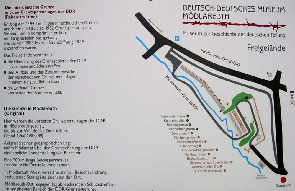
Kleine Rundfahrt durch das Vogtland zum Museum zur innerdeutschen Grenze „Deutsch-Deutsches Museum Mödlareuth“. Überwiegend asphaltierte Straßen, wobei nur die Gefeller Straße S287 recht stark befahren war. Radwegwanderweg Bayerisches Vogtland zwischen Mödlareuth und Königshof geschottert. Hügeliges Geländeprofil.
Routenverlauf:
Reuth > Gefeller Straße Richtung Misslareuth > Spielmes > Rothenacker > Misslareuth > Haidefeld > Gebersreuth > Mödlareuth > Königshof > Töpen > Obertiefendorf > Münchenreuth > Grobau > Gutenfürst > Burgstein > Kemnitz > Dehles > Reuth
Beschreibung der Strecke in http://www.wolf-klepzig.de/hp/rad/Reuth-Toepen-Gutenfuerst-Reuth.pdf.
Weitere Informationen an den Wegpunkten (Parken, Besonderheiten).
Further information at
http://www.wolf-klepzig.de/hp/rad.htmTour gallery
Tour map and elevation profile
Minimum height 498 m
Maximum height 631 m
More about the tour author

|
klegpst |
Comments

Anfahrt:
Je nach Ausgangspunkt über A 72, A9, B173, B2 usw. – als Zieleingabe für Routenplaner Bahnhofstraße, 08538 Reuth oder die Parkplatzkoordinaten eingeben, bei Google Earth und Google maps ohne die Einheitenzeichen für Grad, Minute und Sekunde.
Parken:
Parkplatz am Bahnhof Reuth (N50° 28’ 32.4’’ E11° 57’ 15.2’’) oder nahe der Kirche in der Wallstraße (N50° 28’ 08.4’’ E11° 57’ 37.6’’).
GPS tracks
Trackpoints-
GPX / Garmin Map Source (gpx) download
-
TCX / Garmin Training Center® (tcx) download
-
CRS / Garmin Training Center® (crs) download
-
Google Earth (kml) download
-
G7ToWin (g7t) download
-
TTQV (trk) download
-
Overlay (ovl) download
-
Fugawi (txt) download
-
Kompass (DAV) Track (tk) download
-
Track data sheet (pdf) download
-
Original file of the author (gpx) download
More about the tour author
|
|
klegpst |
Add to my favorites
Remove from my favorites
Edit tags
Open track
My score
Rate