
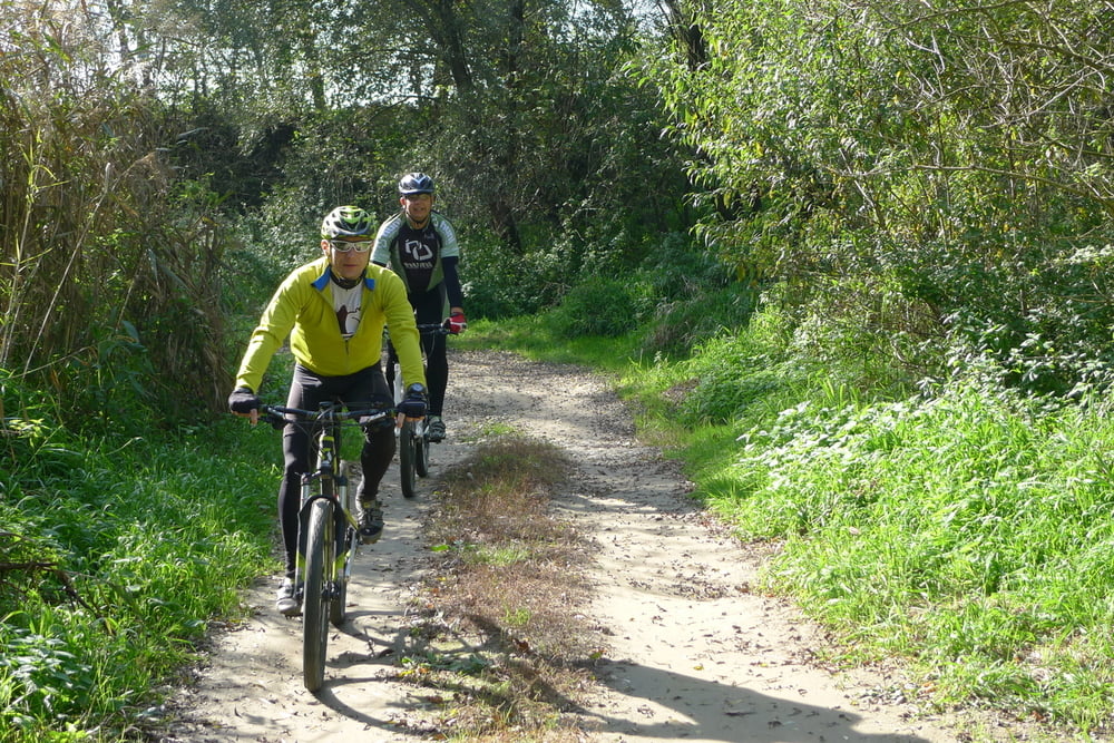

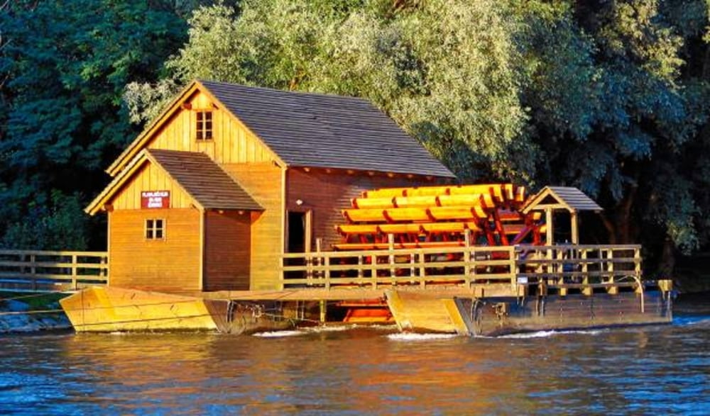
Idealna ruta za početnike i rekreativce koje će možda prvi uspon malo ostaviti bez daha ali nakon toga kreće lijepi spust i nakon toga još jedan uspon nakon kojega se spuštamo u ravnicu i u dolinu Mure. Negdje na pola puta nalazi se Skelareva hiža, mjesto za osvježenje uz samu rijeku Muru. Ova ruta je tehnički prilično ne zahtjevna i pogodna je za početnike u biciklističkom svijetu s iznimkom prvog uspona koji je relativno kratak ali strm.
Napomena: staza je pogodna za TREKKING bicikle.
This is an ideal route for beginners and amateurs who may sweat it out on the first uphill ride, to soon be rewarded by a beautiful downhill ride into the plains and valley of the river Mura. Halfway there is a The Ferryman’s house, a place for refreshments located just at the banks of the river Mura. This route is technically quite undemanding and suitable for beginners in the cycling world with one exception of the first uphill ride, which is relatively short but steep.
Recommendation: THIS TRAIL IS GOOD FOR TREKKING BIKES.
http://spa-sport.hr
http://www.adriabike.hr
Tour gallery
Tour map and elevation profile
Minimum height -39 m
Maximum height 101 m
More about the tour author
|
|
AdriaBikeHotels |
Comments

GPS tracks
Trackpoints-
GPX / Garmin Map Source (gpx) download
-
TCX / Garmin Training Center® (tcx) download
-
CRS / Garmin Training Center® (crs) download
-
Google Earth (kml) download
-
G7ToWin (g7t) download
-
TTQV (trk) download
-
Overlay (ovl) download
-
Fugawi (txt) download
-
Kompass (DAV) Track (tk) download
-
Track data sheet (pdf) download
-
Original file of the author (gpx) download
More about the tour author
|
|
AdriaBikeHotels |
Add to my favorites
Remove from my favorites
Edit tags
Open track
My score
Rate