

Lijepa ruta koja odmah nakon hotela kreće oštro uzbrdo
po asfaltnoj cesti a zatim nakon panoramske ceste kreće
spust u nizinu te se vožnja nastavlja po makadamskoj cesti
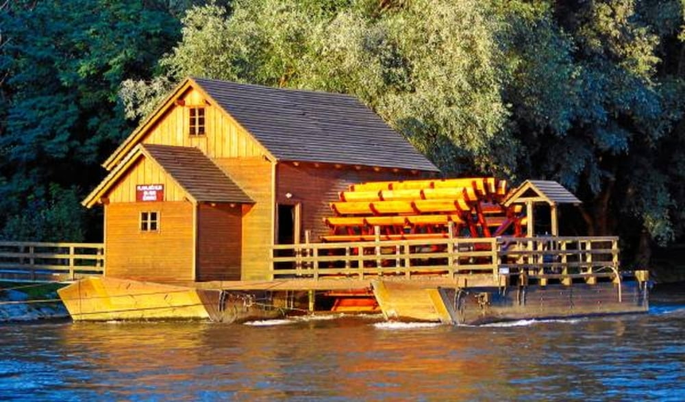
uz rijeku Muru. Skelarova hiža na ruti odlično je mjesto
za osvježenje a nakon toga penjemo se nazad u “brege”
gdje nas singletral na lokalnoj XC stazi vodi nazad u hotel.
Ne zahtjevna ruta sa nekoliko strmih uspona idealna je za
MTB početnike ali i one nešto iskusnije.
A nice route that goes sharply uphill right after you leave the hotel begins on the paved road that takes you through the lovely scenery and on a downhill ride. The ride continues on the gravel road along the river Mura. On this trail there is The Ferryman’s house, a great place for refreshments. Refreshed, we climb back into the hills where a single trial on local XC leads us back to the hotel. This is an undemanding route with several steep uphill rides, ideal for MTB beginners and those more experienced ones.
http://spa-sport.hr
http://www.adriabike.hr
Tour gallery
Tour map and elevation profile
Minimum height 158 m
Maximum height 333 m
More about the tour author
|
|
AdriaBikeHotels |
Comments

GPS tracks
Trackpoints-
GPX / Garmin Map Source (gpx) download
-
TCX / Garmin Training Center® (tcx) download
-
CRS / Garmin Training Center® (crs) download
-
Google Earth (kml) download
-
G7ToWin (g7t) download
-
TTQV (trk) download
-
Overlay (ovl) download
-
Fugawi (txt) download
-
Kompass (DAV) Track (tk) download
-
Track data sheet (pdf) download
-
Original file of the author (gpx) download
More about the tour author
|
|
AdriaBikeHotels |
Add to my favorites
Remove from my favorites
Edit tags
Open track
My score
Rate