


Eine Runde zwischen Schwarzenbach und Kirkel mit einer nördlichen Rücktour.
Auf bekanntem Weg von Schwarzenbach nach Kirkel.
Die Rückrunde steigt zuerst in einem Bogen auf den Steigberg an. Dann nach rechts und über schöne Forstwege nach Nordost.
Nachdem die l113 überquert wurde kommen ein paar schmalere Wege mit etwas Gestrüpp das aber nicht zu stark stört. Bald danach fand ich mich wieder auf Forstwegen und gelangte so tangential an Furpach vorbei nach Kohlhof.
Das Wegstück von Niederbexbach zur Altstadt Kirkel durch die Talaue war etwas matschig und grasig. Stört nicht weiter.
Nun war ich wieder auf bekanntem Gelände und rollte bald durch die Felder in Richtung Homburg zu Edekaa und dann zum Ausgangspunkt zurück.
Further information at
http://www.hvsn.de/index.php?option=com_content&task=view&id=135Tour gallery
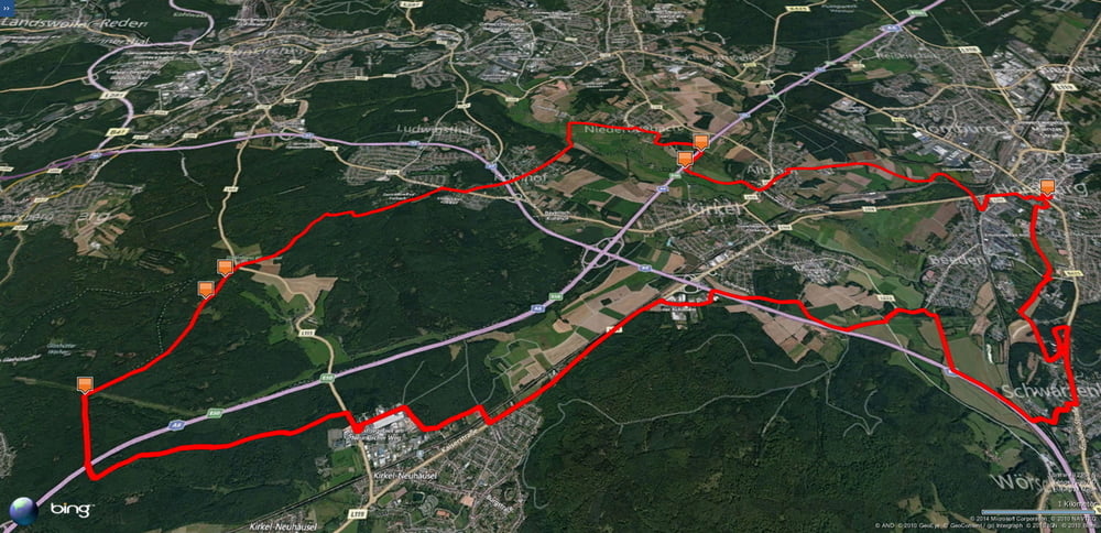
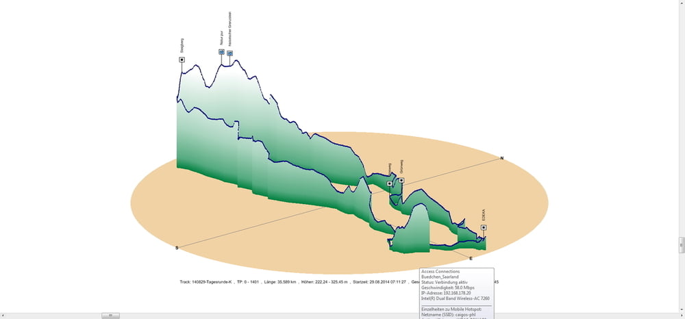
Tour map and elevation profile
Minimum height 222 m
Maximum height 369 m
More about the tour author
|
|
Pheinz |
Comments

In Schwarzenbach geht es los.
GPS tracks
Trackpoints-
GPX / Garmin Map Source (gpx) download
-
TCX / Garmin Training Center® (tcx) download
-
CRS / Garmin Training Center® (crs) download
-
Google Earth (kml) download
-
G7ToWin (g7t) download
-
TTQV (trk) download
-
Overlay (ovl) download
-
Fugawi (txt) download
-
Kompass (DAV) Track (tk) download
-
Track data sheet (pdf) download
-
Original file of the author (gpx) download
More about the tour author
|
|
Pheinz |
Add to my favorites
Remove from my favorites
Edit tags
Open track
My score
Rate