


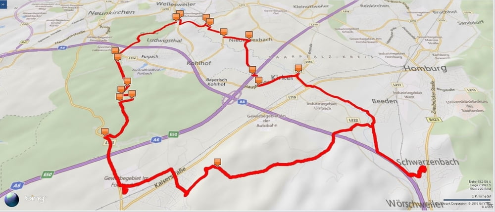
Den ersten Teil meiner Runde nahm ich durch das Blies- und Taubental nach Kirkel-Neuhäusel.
Am Abend radelte ich nach Norden aus Kirkel-Neuhäusel hinaus und bog hinter der Autobahn nach rechts in den Wald ab und nahm die erste Steigung auf den Rücken. Nun suchte ich mir meinen Weg durch den wunderschönen Wald bis ich zwischen den Ortschaften Ludwigsthal und Neunkirchen den Pfuhlwald erreiche und durchquerte.
Auf dem Radweg an der L226 überquerte ich die Blies und fuhr anschleßend nach Niederbexbach. Hinter einem Rennrädler nahm ich nun Geschwindigkeit auf und gelangte mit leicht erhöhtem Puls nach Kirkel wo ich dann den Bliestalradweg, vorbei am Beedener Biotop zurück zum Ausgangspunkt gelangte.
Further information at
http://www.pfaelzischer-merkur.de/lokales/lokalimport/saarpfalz/homburg/Homburg-Lebensraum-von-Wasserbueffeln-und-Weissstoerchen-entdecken;art27550,4372821Tour gallery
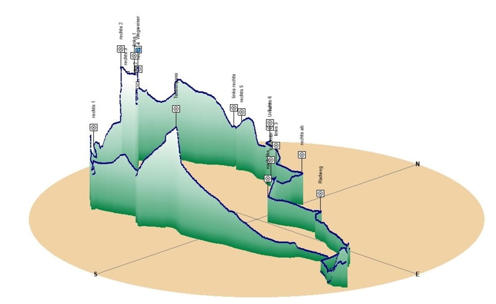
Tour map and elevation profile
Minimum height 225 m
Maximum height 332 m
More about the tour author
|
|
Pheinz |
Comments

Start und Ziel in Schwarzenbach.
GPS tracks
Trackpoints-
GPX / Garmin Map Source (gpx) download
-
TCX / Garmin Training Center® (tcx) download
-
CRS / Garmin Training Center® (crs) download
-
Google Earth (kml) download
-
G7ToWin (g7t) download
-
TTQV (trk) download
-
Overlay (ovl) download
-
Fugawi (txt) download
-
Kompass (DAV) Track (tk) download
-
Track data sheet (pdf) download
-
Original file of the author (gpx) download
More about the tour author
|
|
Pheinz |
Add to my favorites
Remove from my favorites
Edit tags
Open track
My score
Rate