
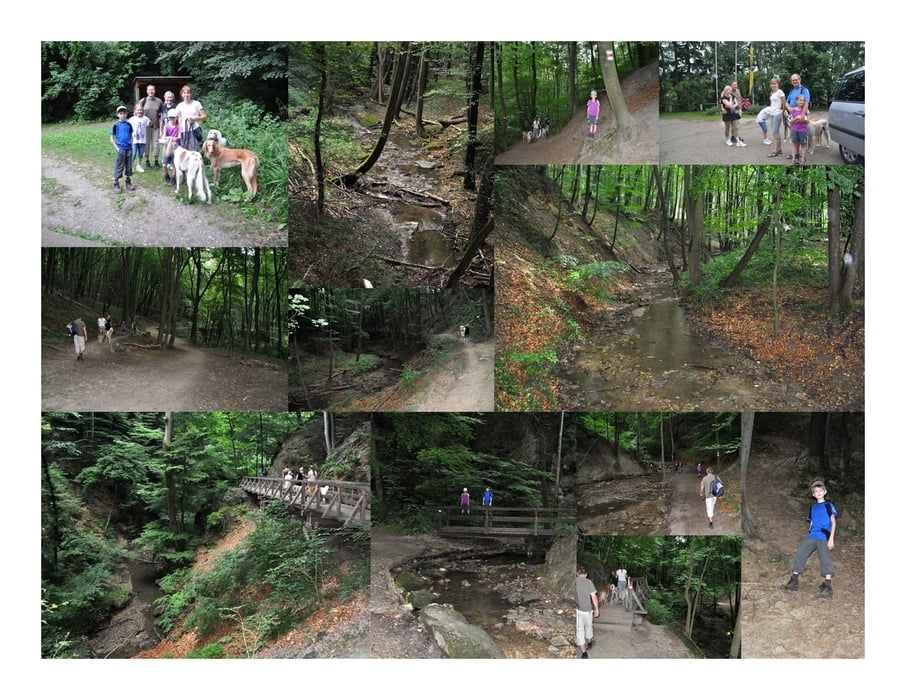

Der Naturpark Eichenhain hat in Unterkirchbach einen eigenen kleinen Parkplatz (gratis). Von dort folgt man dem Klammweg einige hundert Meter und kommt so direkt zum Eingang der Klamm.
Die Klamm beginnt recht unscheinbar und man folgt dem kleinen Rinnsal Hagenbach. In Folge überqueren wir einige Brücken und folgen dem Hagenbach flussabwärts.
Der Bach windet sich durch den Wald und zieht in tiefen Gräben seinen Weg. Einige kleine (künstliche) Wasserfälle geben eine wunderbare Geräuschkulisse.
Nach ca. 3 km erreichen wir das Ende der Hagenbachklamm.
Dort kehren wir um und folgenden dem gleichen Weg retour.
Tipp: http://www.bonka.at/ Das Wirtshaus liegt ca. 1,6 km von der Hagenbachklamm entfernt und ist ein echter Tipp für Gourmet-Wirtshaus-Geher :)
Further information at
http://www.naturparke.at/de/Naturparke/Niederoesterreich/Eichenhain/Wandertipp_2009Tour map and elevation profile
Minimum height 269 m
Maximum height 330 m
Comments

Start der Tour ist am Parkplatz Naturpark Eichenhain mit den Koordinaten N48 17 34.3, E16 11 48.7. Dann folgt man dem Klammweg (beschildert) vorbei an der Greifvogelstation und dem Ponnyhof bis zum Beginn der Klamm.
GPS tracks
Trackpoints-
GPX / Garmin Map Source (gpx) download
-
TCX / Garmin Training Center® (tcx) download
-
CRS / Garmin Training Center® (crs) download
-
Google Earth (kml) download
-
G7ToWin (g7t) download
-
TTQV (trk) download
-
Overlay (ovl) download
-
Fugawi (txt) download
-
Kompass (DAV) Track (tk) download
-
Track data sheet (pdf) download
-
Original file of the author (gpx) download
Add to my favorites
Remove from my favorites
Edit tags
Open track
My score
Rate