
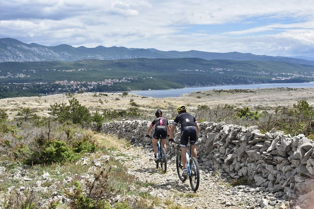

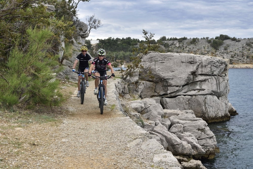
Ovu stazu bi mogli nazvati i "Classic" s obzirom da je ovo vjerojatno najčešći izbor rekreativaca brdskih biciklista. Staza kreće prema Omišlju po makadamu s manjim asfaltnim dijelom, a nakon Omišlja predivnom stazom uz samu morsku obalu sve do riječkog (krčkog) aerodroma. Nakon aerodroma počinje makadam koji nakon nekog vremena prelazi u usku stazu (singletrail) koji vodi do jedine spilje na otoku Krku, spilje Biserujke. Povratak do Njivica je po zahtjevnoj makadamskoj cesti.
The route could also be named “Classic" considering it is the most common choice of recreational mountain bikers. The route starts towards Omišalj on macadam with smaller asphalt part and follows on a beautiful trail along the very seaside all to the Rijeka (Krk) airport. It continues on macadam which then turns into a narrow trail (single trail) which leads to a cave on the island of Krk – Biserujka. Return to Njivice is on a demanding macadam road.
www.adriabike.hr
http://www.njiviceresort.com
Tour gallery
Tour map and elevation profile
Minimum height -6 m
Maximum height 88 m
More about the tour author
|
|
AdriaBikeHotels |
Comments

GPS tracks
Trackpoints-
GPX / Garmin Map Source (gpx) download
-
TCX / Garmin Training Center® (tcx) download
-
CRS / Garmin Training Center® (crs) download
-
Google Earth (kml) download
-
G7ToWin (g7t) download
-
TTQV (trk) download
-
Overlay (ovl) download
-
Fugawi (txt) download
-
Kompass (DAV) Track (tk) download
-
Track data sheet (pdf) download
-
Original file of the author (gpx) download
More about the tour author
|
|
AdriaBikeHotels |
Add to my favorites
Remove from my favorites
Edit tags
Open track
My score
Rate