


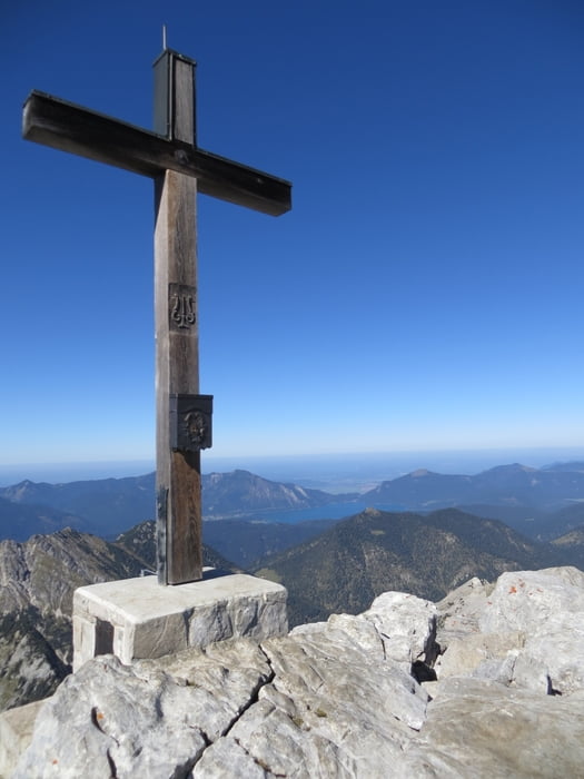
Soiernspitze (2.257m) im bayrischen Karwendel
Start&Ziel Wanderparkplatz am Isarknie bei Mittenwald
Aufstieg über Ochsenalm und 359 Richtung Feldernkreuz, Abstecher zum Seinskopf
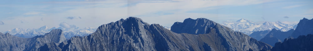
Am Feldernkreuz (2048m) Abstecher zur Schöttelkarspitze (2049m) mit schönem Rundblick (Walchensee, Wallgau, Estergebirge, Soiernspitze)
Gratweg bis Soiernspitze
Abstieg über Vereineralm und weiter den Forstweg bis Wanderparkplatz Star&Ziel
Variante im Abstieg ab Soiernspitze zurück über Gratweg und Signalkopf/Lausberg (die letzten 20min sind allerdings in zahllosen Kehren etwas speziell)
Tour gallery
Tour map and elevation profile
Minimum height 909 m
Maximum height 2262 m
More about the tour author
|
|
Mathis_muc |
Comments

GPS tracks
Trackpoints-
GPX / Garmin Map Source (gpx) download
-
TCX / Garmin Training Center® (tcx) download
-
CRS / Garmin Training Center® (crs) download
-
Google Earth (kml) download
-
G7ToWin (g7t) download
-
TTQV (trk) download
-
Overlay (ovl) download
-
Fugawi (txt) download
-
Kompass (DAV) Track (tk) download
-
Track data sheet (pdf) download
-
Original file of the author (gpx) download
More about the tour author
|
|
Mathis_muc |
Add to my favorites
Remove from my favorites
Edit tags
Open track
My score
Rate