Login

Forgot your login?

Cookies have to be accepted!
Your browser's cookie functionality is disabled. Please enable this functionality.

Not a member yet?

Register now
Login

Available for registred users only

Log in to use this feature.

Forgot your login?

Cookies have to be accepted!
Your browser's cookie functionality is disabled. Please enable this functionality.

Not a member yet?

Register now
Filter
Categories
Advanced filters
  • Distance (km)
  • Height
Save filters Reset filter

TrackRank

QRCode

Technical data

Distance10,5 km Height1202 m Way down1198 m Duration00:00 h:m Date17.04.2016
Scores Author Landscape Fun factor Fitness Technique

Statistics

324 Views Scores 18 Downloads Average
Rate
  • Track data sheet
  • Directions
  • Downloads
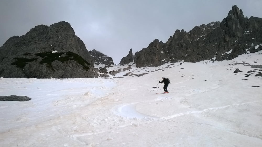
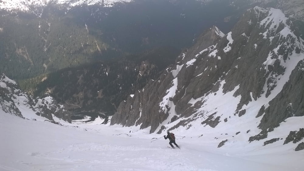
possibilità di salire la cima sud dei Longerin, scendendo per 100 metri dalla forcella verso sud e poi risalirw a dx verso la cima

Further information at

https://goo.gl/photos/oDtqc268F98JNcQ57

Tour gallery

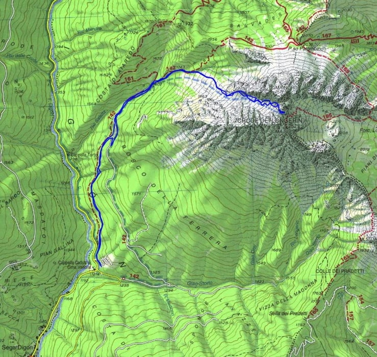
Tour map and elevation profile

  • Open Street Map
  • Google
Minimum height 1220 m Maximum height 2459 m Detailed view

More about the tour author

dalle6161
Member since 2011

Send private message

Comments

GPS tracks

Trackpoints
  • GPX / Garmin Map Source (gpx) download
  • TCX / Garmin Training Center® (tcx) download
  • CRS / Garmin Training Center® (crs) download
  • Google Earth (kml) download
  • G7ToWin (g7t) download
  • TTQV (trk) download
  • Overlay (ovl) download
  • Fugawi (txt) download
  • Kompass (DAV) Track (tk) download
  • Track data sheet (pdf) download
  • Original file of the author (gpx) download

More about the tour author

dalle6161
Member since 2011

Send private message
Share track
Add to my favorites
Remove from my favorites
Edit tags
My score
Rate
Track: forcella fra i longerin da ovest
Type: Ski touring
Distance: 10,5 km
Evaluated on:
Duration:
Day(s)
Hour(s)
Minute(s)
Score: Landscape Fun factor Fitness Technique