


Tourendatum: 27.08.2016
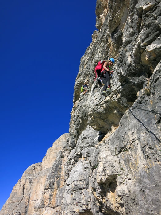
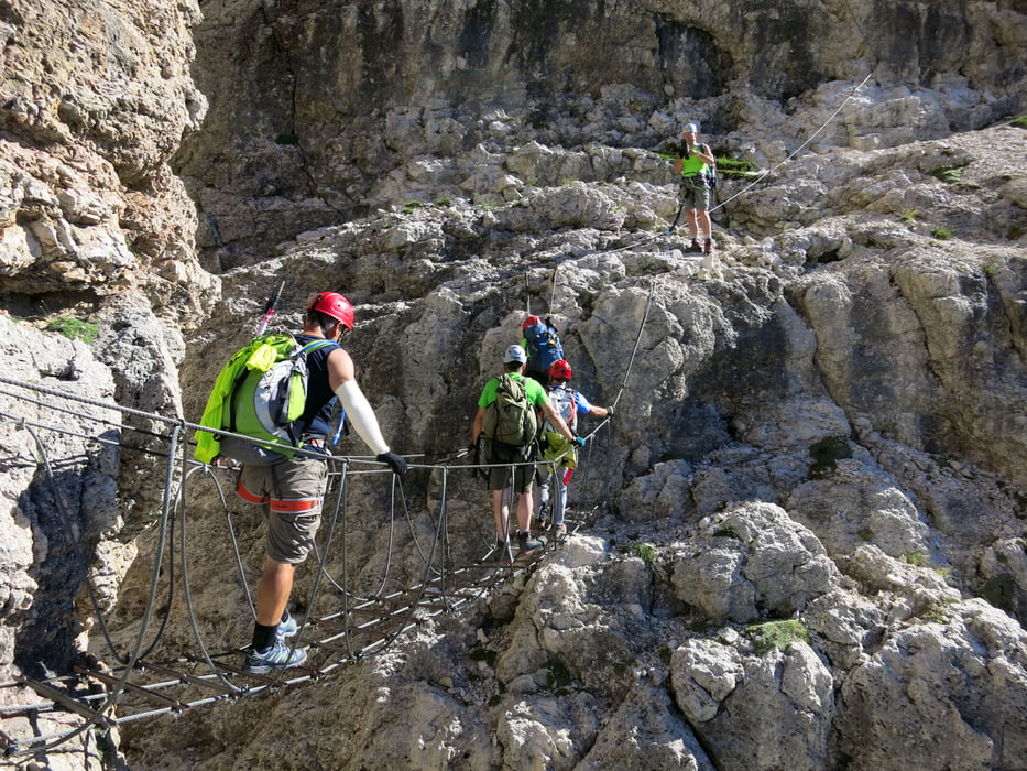
Tourensteckbrief: Sportlicher, nicht allzu langer, schwieriger Klettersteig (D) auf die höchste Erhebung des Sellastockes, den Piz Boe 3152m. Landschaftlich sehr schöne Blicke nach Süden Richtung Marmolada, am Gipfel tolles Rundumpanorama. Die Schlüsselpassage ist gleich das ca. 10m hohe steile, trittarme Einstiegswandl, das schon einiges an Armkraft verlangt, aber sehr gut mit straffem Stahlseil und Zwischensicherungen in kurzen Abständen abgesichert ist. Danach sehr abwechslungsreiche Kletterei mit einer kurzen Hängebrücke und einigen schönen Quergängen.
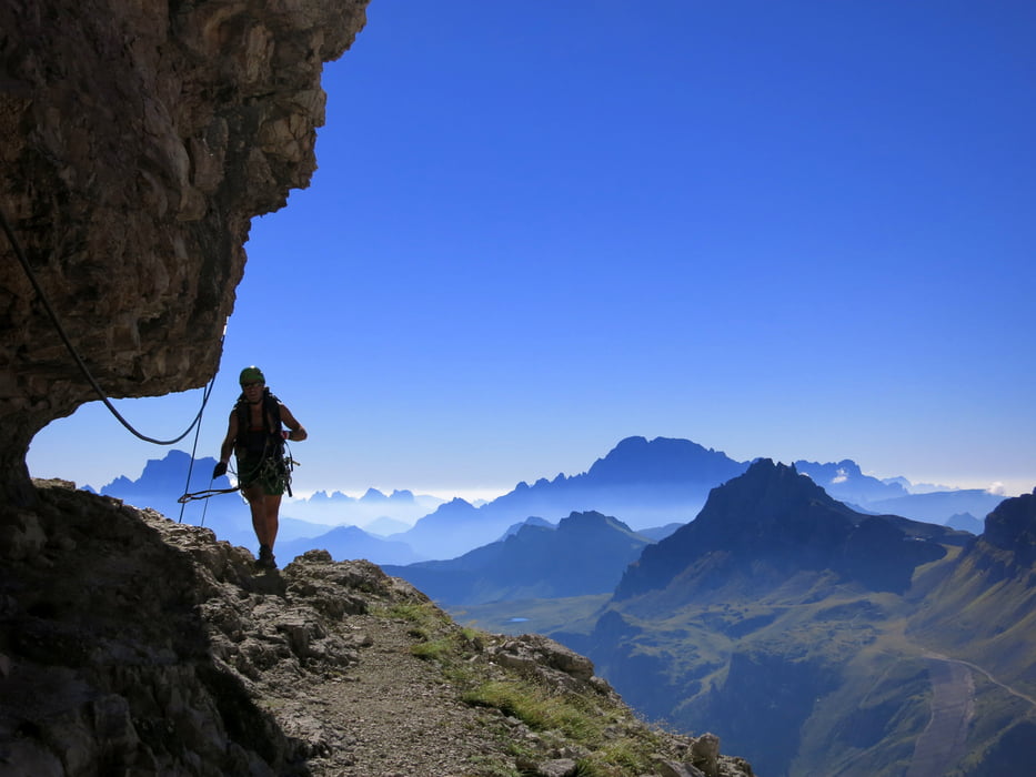
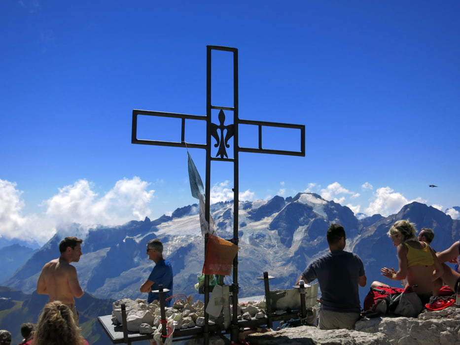
Im obersten Teil auch kurze Gehgeländepassagen, die schwierigeren Stellen sind alle mit Stahlseil abgesichert. Nach dem Ende der Drahtseile gehts noch ca. 30-45 Min über einen schottrigen Steig zum Gipfel des Piz Boe (3152) mit dem Rif. Cap. Fassa hinauf. Dort oben hat man eine herrliche Rundumsicht, die man sich aber mit vielen Seilbahntouristen, die über die Pordoispitze heraufgegondelt sind, teilen muss.
Der Abstieg erfolgt über die Pordoischarte mit dem Rif. del Pordoi (2829) und dem steilen, schuttigen Weg direkt zum Pordoipass hinab.
Zeiten: PP - Einstieg ca. 1h
Klettersteig bis Ausstieg ca. 2-2,5h
Ausstieg - Gipfel ca. 0,5 - 0,75 h
Abstieg zum Pordoijoch ca, 1,5h
zurück zum PP nahe Soldatenfriedhof ca. 15 Min
-> Gesamtzeit ca. 5h
Absolut lohnende Tour auf den höchsten Sella-Gipfel.
Further information at
https://photos.google.com/share/AF1QipOPgScUgUijIM7Nc3qFh-1o63s-DLX0mb67pAgsRol0-lOkBIVmW2QttxttH8d1dw?key=b0lYdjVTNkZGSWlRVHh6YlhoMGJRcS0wYXNEZWZnTour gallery
Tour map and elevation profile
Minimum height 2198 m
Maximum height 3158 m
More about the tour author
|
|
Eimy |
Comments

Von Canazei auf den Pordoipass, dort zweigt links ein Asphaltsträsschen zum Soldatenfriedhof (Ossario del Pordoi) ab; kurz vor dem Friedhof rechts einige Parkmöglichkeiten für Klettersteigler.
Oder: von Arabba auf den Pordoipass und weiter wie oben beschrieben.
GPS tracks
Trackpoints-
GPX / Garmin Map Source (gpx) download
-
TCX / Garmin Training Center® (tcx) download
-
CRS / Garmin Training Center® (crs) download
-
Google Earth (kml) download
-
G7ToWin (g7t) download
-
TTQV (trk) download
-
Overlay (ovl) download
-
Fugawi (txt) download
-
Kompass (DAV) Track (tk) download
-
Track data sheet (pdf) download
-
Original file of the author (gpx) download
More about the tour author
|
|
Eimy |
Add to my favorites
Remove from my favorites
Edit tags
Open track
My score
Rate