


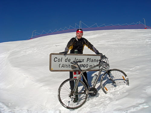
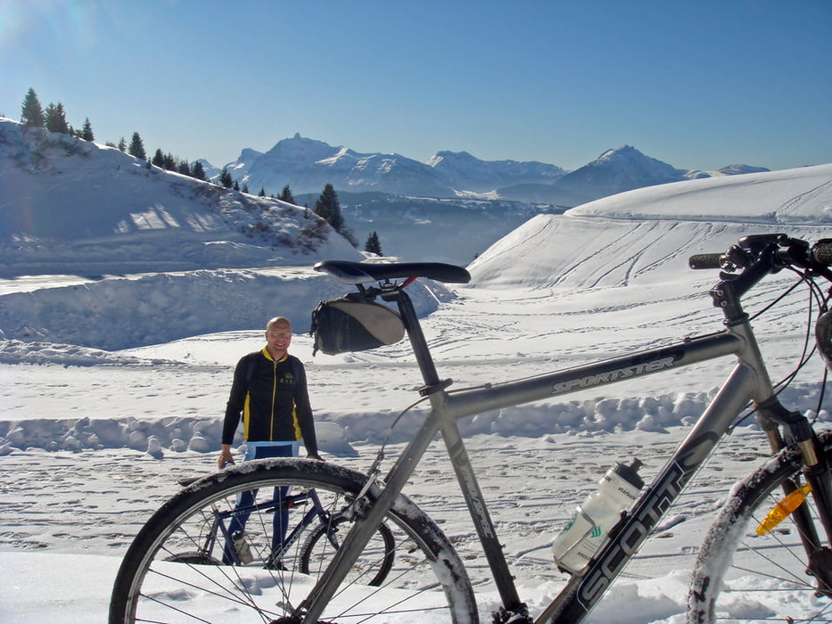
Winter ride up to the legendary Col de Joux Plane.
Armstrong suffered here in 2000 against Virenque. In 2006, it was the last climb on the "miracle" Landis day.
Further information at
http://www.cycling-challenge.com/col-de-joux-plane-in-winter/Tour gallery
Tour map and elevation profile
Minimum height 653 m
Maximum height 1705 m
More about the tour author
|
|
lecycliste |
Comments

We started in Morrilon for 5 flat kms. At samoens just follow the signs to Joux Plane.
In summer a road bike is OK.
In winter, the route is kept fairly clear for the ski de Fond at the top, but the roads are still slippery.
GPS tracks
Trackpoints-
GPX / Garmin Map Source (gpx) download
-
TCX / Garmin Training Center® (tcx) download
-
CRS / Garmin Training Center® (crs) download
-
Google Earth (kml) download
-
G7ToWin (g7t) download
-
TTQV (trk) download
-
Overlay (ovl) download
-
Fugawi (txt) download
-
Kompass (DAV) Track (tk) download
-
Track data sheet (pdf) download
-
Original file of the author (gpx) download
More about the tour author
|
|
lecycliste |
Add to my favorites
Remove from my favorites
Edit tags
Open track
My score
Rate