Login

Forgot your login?

Cookies have to be accepted!
Your browser's cookie functionality is disabled. Please enable this functionality.

Not a member yet?

Register now
Login

Available for registred users only

Log in to use this feature.

Forgot your login?

Cookies have to be accepted!
Your browser's cookie functionality is disabled. Please enable this functionality.

Not a member yet?

Register now
Filter
Categories
Advanced filters
  • Distance (km)
  • Height
Save filters Reset filter

TrackRank

QRCode

Technical data

Distance53,2 km Height2836 m Way down1235 m Duration07:45 h:m Date08.02.2009
Scores Author Landscape Fun factor Fitness Technique

Statistics

1544 Views Scores 360 Downloads Average
Rate
  • Track data sheet
  • Directions
  • Downloads

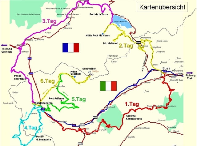
Westalpentour:   Tour du Mont Cenis


2. Etappe:  Mont Malamot Stichstraße


Start: Susa

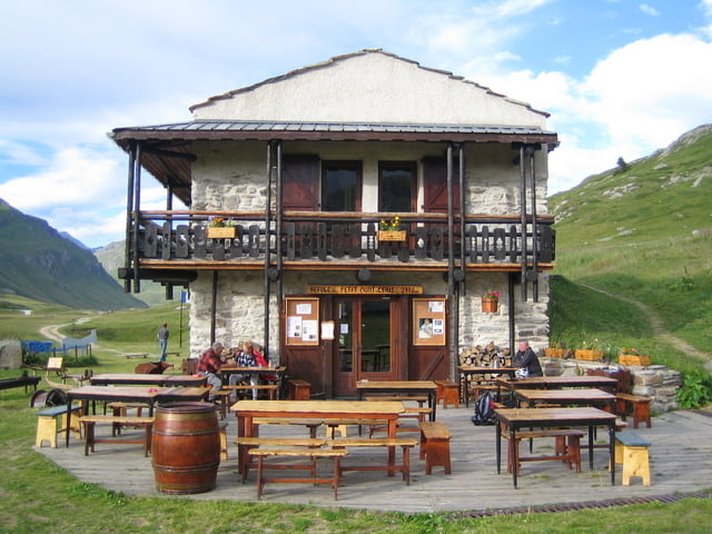
Ziel:   Berghütte Petit Mont Cenis


Übernachtungsempfehlung:

Susa:            Hotel Napoleon
Berghütte:    Petit Mont Cenis


nächste Etappe siehe „über den Col de Fréjus“  3. Etappe 
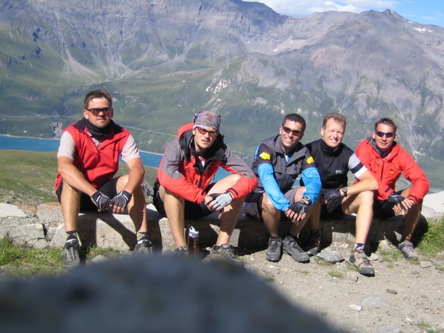
 

Tour gallery

Tour map and elevation profile

  • Open Street Map
  • Google
Minimum height 419 m Maximum height 2894 m Detailed view

More about the tour author

mboss100
Member since 2009

Send private message

Comments

GPS tracks

Trackpoints
  • GPX / Garmin Map Source (gpx) download
  • TCX / Garmin Training Center® (tcx) download
  • CRS / Garmin Training Center® (crs) download
  • Google Earth (kml) download
  • G7ToWin (g7t) download
  • TTQV (trk) download
  • Overlay (ovl) download
  • Fugawi (txt) download
  • Kompass (DAV) Track (tk) download
  • Track data sheet (pdf) download
  • Original file of the author (gpx) download

More about the tour author

mboss100
Member since 2009

Send private message
Share track
Add to my favorites
Remove from my favorites
Edit tags
My score
Rate
Track: 2.Tag: Mont Malamot Stichstraße
Type: Mountain bike
Distance: 53,2 km
Evaluated on:
Duration:
Day(s)
Hour(s)
Minute(s)
Score: Landscape Fun factor Fitness Technique