


Eine landschaftlich sehr schöne Tour im oberen Ennstal. Beginnen kann man eigentlich wo man will, in diesem Fall beginnt die Tour beim "Würstelbaron" in Lengdorf (N47 28.262 E13 56.467) und endet auch wieder hier.
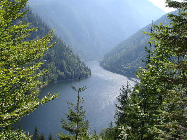
Auf der Begleitstraße der B320 ist man schnell in Gröbming, über die Öfen (ein sehr beeindruckendes Stück Steiermark) hinauf bis man dann zur Alm kommt, dort kann man nach einer zünftigen Jause gestärkt die Abfahrt beginnen. Spätestens jetzt merkt man, daß man doch einige Höhenmeter zurück gelegt hat. Hier wird man auch mit einigen schönen Ausblicken für die Anstrengungen entlohnt. Zurück über den Paß Stein zum Ausgangspunkt in Lengdorf! Viel Spaß!
Auf der Begleitstraße der B320 ist man schnell in Gröbming, über die Öfen (ein sehr beeindruckendes Stück Steiermark) hinauf bis man dann zur Alm kommt, dort kann man nach einer zünftigen Jause gestärkt die Abfahrt beginnen. Spätestens jetzt merkt man, daß man doch einige Höhenmeter zurück gelegt hat. Hier wird man auch mit einigen schönen Ausblicken für die Anstrengungen entlohnt. Zurück über den Paß Stein zum Ausgangspunkt in Lengdorf! Viel Spaß!
Tour gallery
Tour map and elevation profile
Minimum height 671 m
Maximum height 1494 m
More about the tour author

|
Comments

N47 28.262 E13 56.467
GPS tracks
Trackpoints-
GPX / Garmin Map Source (gpx) download
-
TCX / Garmin Training Center® (tcx) download
-
CRS / Garmin Training Center® (crs) download
-
Google Earth (kml) download
-
G7ToWin (g7t) download
-
TTQV (trk) download
-
Overlay (ovl) download
-
Fugawi (txt) download
-
Kompass (DAV) Track (tk) download
-
Track data sheet (pdf) download
More about the tour author
|
|
Add to my favorites
Remove from my favorites
Edit tags
Open track
My score
Rate