


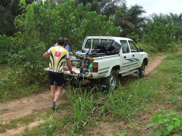
It was the first tour in this area. We always went to the beach there and considering of one time going there to bike which we now finally did. No idea of where to go we just started in one direction. After only 10 minutes we had the first setback. One of us had is rear axle broken and had to return. The rest of us headed further into the jungle looking for trails. After one deadend we finally found some really nice trails worth of going back there. Plenty of more trails are out there to be explored. Biggest setback on the tour was the accident of on of us. Sliding around a corner and loosing grip in sand he fell and landed with his leg on a stump - a sharp stump which went straight into the leg ripping it open to the muscle. Not a nice thing to happen in the middle of nowhere. First aid was applied and then we had to head out to some more accessible path. From there two of us where getting a car to evacuate our injured buddy.
Tour gallery
Tour map and elevation profile
Minimum height 16 m
Maximum height 52 m
More about the tour author

|
mrunte |
Comments

45 minutes east out of Port Harcourt into the direction Aba. At Obhele you turn right to go to and through Ekwete. After Ekwete you turn right until you arrive at the Azumini River from where you can start the tour.
GPS tracks
Trackpoints-
GPX / Garmin Map Source (gpx) download
-
TCX / Garmin Training Center® (tcx) download
-
CRS / Garmin Training Center® (crs) download
-
Google Earth (kml) download
-
G7ToWin (g7t) download
-
TTQV (trk) download
-
Overlay (ovl) download
-
Fugawi (txt) download
-
Kompass (DAV) Track (tk) download
-
Track data sheet (pdf) download
-
Original file of the author (gpx) download
More about the tour author
|
|
mrunte |
Add to my favorites
Remove from my favorites
Edit tags
Open track
My score
Rate