

Tour from Lacona up/down to the Mt. Tambone, also tour up/down from Marina di Campo to Mt. Tambone.
Down the trail is difficult but ok.
There is another tour from Locana to the Mt. Tambone back to Lacona. The beginnung from Lacona to half of Mt. Tambone uses the street (see the other track for an alternative uphill).
I drove this tour with the Mt. Perone Pietra Maruta Tour (see there).
Down the trail is difficult but ok.
There is another tour from Locana to the Mt. Tambone back to Lacona. The beginnung from Lacona to half of Mt. Tambone uses the street (see the other track for an alternative uphill).
I drove this tour with the Mt. Perone Pietra Maruta Tour (see there).
Further information at
http://www.gps-tour.info/tours/view.php?action=view&entity=list&limitstart=0&country=Italien&federal=ToskanaTour gallery
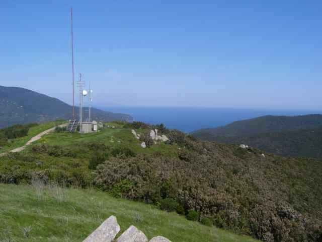
Tour map and elevation profile
Minimum height 3 m
Maximum height 380 m
More about the tour author
|
|
skyhopper |
Comments
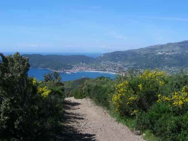
Portoferrario, Locana, at the village end of Lacona in direction to Marina di Campo park the car (or come from Marina di Campo - see Capane tour for description).
GPS tracks
Trackpoints-
GPX / Garmin Map Source (gpx) download
-
TCX / Garmin Training Center® (tcx) download
-
CRS / Garmin Training Center® (crs) download
-
Google Earth (kml) download
-
G7ToWin (g7t) download
-
TTQV (trk) download
-
Overlay (ovl) download
-
Fugawi (txt) download
-
Kompass (DAV) Track (tk) download
-
Track data sheet (pdf) download
-
Original file of the author (gpx) download
More about the tour author
|
|
skyhopper |
Add to my favorites
Remove from my favorites
Edit tags
Open track
My score
Rate
Strecke abgefahren
1. Die Abfahrt nach Lacona ist mit Schiebepassagen versehen, besonders in der unteren Hälfte (auch für Geübte).
2. Die Auffahrt von Marina di Campo ist teilweise steil und in der oberen Hälfte etwas Verblockt.
3. Würde die Abfahrt nach Lancona über die Schotterpiste nehmen (Marathonstrecke), da diese auch sehr verblockt ist aber dafür mit super Aussicht auf die Laconabucht.
S3 Trails