
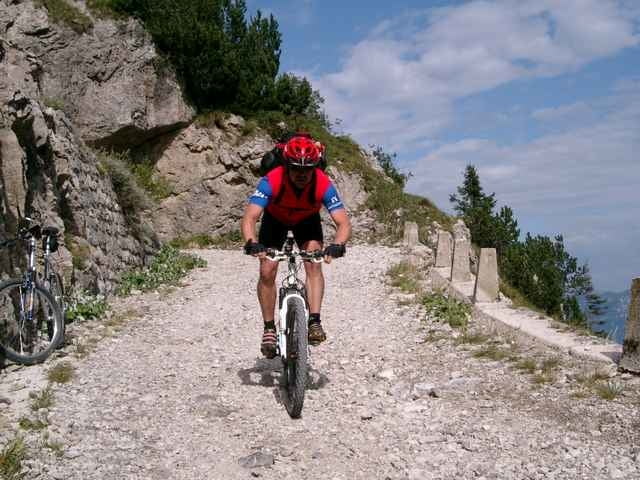

Vom Startpunkt in Limone (Hotel Leonardo Da Vinci) geht wiedermal die Straße hoch nach Vesio. Von hieraus weiter der Straße folgend nach Polzone. Hier biegt rechts ein Schotterweg ab, der durch das Valle San Michele erstmal einige hundert Meter bergabführt. Nicht weit nach einem kleinem Stausee biegt links ein teils befestigter, steil ansteigender Weg ab. Vorbei an einem Wasserfall und ein paar Almen kommt man über fast endlose Schotterwege zum Rifugio Garda.
Hier am wohl bekanntesten Treffpunkt in der Region - abgesehen von Mecky´s Bar - kann nochmal für den letzten Anstieg getankt werden. Nach weiteren 200 hm erreicht man den Passo Tremalzo und fährt durch das Tunnel hin zur wohl schönsten und längsten Abfahrt am westlichen Gardasee.
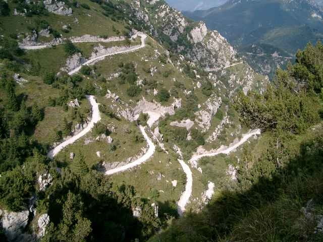
Die nun folgenden enlosen Serpentienen, mit grandionsen Ausblicken auf den Lago, führen vorbei am Passo Nota wieder runter nach Vesio und weiter nach Limone.
Hier am wohl bekanntesten Treffpunkt in der Region - abgesehen von Mecky´s Bar - kann nochmal für den letzten Anstieg getankt werden. Nach weiteren 200 hm erreicht man den Passo Tremalzo und fährt durch das Tunnel hin zur wohl schönsten und längsten Abfahrt am westlichen Gardasee.
Die nun folgenden enlosen Serpentienen, mit grandionsen Ausblicken auf den Lago, führen vorbei am Passo Nota wieder runter nach Vesio und weiter nach Limone.
Tour gallery
Tour map and elevation profile
Minimum height 84 m
Maximum height 1824 m
More about the tour author

|
Comments

GPS tracks
Trackpoints-
GPX / Garmin Map Source (gpx) download
-
TCX / Garmin Training Center® (tcx) download
-
CRS / Garmin Training Center® (crs) download
-
Google Earth (kml) download
-
G7ToWin (g7t) download
-
TTQV (trk) download
-
Overlay (ovl) download
-
Fugawi (txt) download
-
Kompass (DAV) Track (tk) download
-
Track data sheet (pdf) download
-
Original file of the author (g7t) download
More about the tour author
|
|
Add to my favorites
Remove from my favorites
Edit tags
Open track
My score
Rate