Login

Forgot your login?

Cookies have to be accepted!
Your browser's cookie functionality is disabled. Please enable this functionality.

Not a member yet?

Register now
Login

Available for registred users only

Log in to use this feature.

Forgot your login?

Cookies have to be accepted!
Your browser's cookie functionality is disabled. Please enable this functionality.

Not a member yet?

Register now
Filter
Categories
Advanced filters
  • Distance (km)
  • Height
Save filters Reset filter

TrackRank

QRCode

Technical data

Distance34,8 km Height1042 m Way down1090 m Duration03:00 h:m Date03.05.2009
Scores Author Landscape Fun factor Fitness Technique

Statistics

330 Views Scores 39 Downloads Average
Rate
  • Track data sheet
  • Directions
  • Downloads
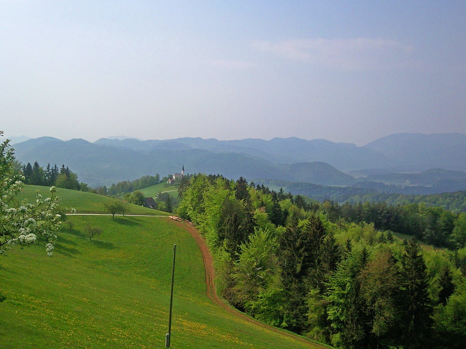
Pot je možno zvoziti tudi s "trdakom", vendar zaradi posameznih izpostavljenih mest priporočam polnovzmeteno kolo. Pot je v celoti prevozna, razen cca 40 metrov, kjer je prehod po peš poti na kolovoz.

Tour gallery

Tour map and elevation profile

  • Open Street Map
  • Google
Minimum height 262 m Maximum height 712 m Detailed view

More about the tour author

katurocman
Member since 2008

Send private message

Comments

GPS tracks

Trackpoints
  • GPX / Garmin Map Source (gpx) download
  • TCX / Garmin Training Center® (tcx) download
  • CRS / Garmin Training Center® (crs) download
  • Google Earth (kml) download
  • G7ToWin (g7t) download
  • TTQV (trk) download
  • Overlay (ovl) download
  • Fugawi (txt) download
  • Kompass (DAV) Track (tk) download
  • Track data sheet (pdf) download
  • Original file of the author (gpx) download

More about the tour author

katurocman
Member since 2008

Send private message
Share track
Add to my favorites
Remove from my favorites
Edit tags
My score
Rate
Track: Lepa njiva-Skorno
Type: Mountain bike
Distance: 34,8 km
Evaluated on:
Duration:
Day(s)
Hour(s)
Minute(s)
Score: Landscape Fun factor Fitness Technique