Login

Forgot your login?

Cookies have to be accepted!
Your browser's cookie functionality is disabled. Please enable this functionality.

Not a member yet?

Register now
Login

Available for registred users only

Log in to use this feature.

Forgot your login?

Cookies have to be accepted!
Your browser's cookie functionality is disabled. Please enable this functionality.

Not a member yet?

Register now
Filter
Categories
Advanced filters
  • Distance (km)
  • Height
Save filters Reset filter

TrackRank

QRCode

Technical data

Distance34,6 km Height1169 m Way down1165 m Duration02:15 h:m Date24.05.2009
Scores Author Landscape Fun factor Fitness Technique

Statistics

329 Views Scores 31 Downloads Average
Rate
  • Track data sheet
  • Directions
  • Downloads
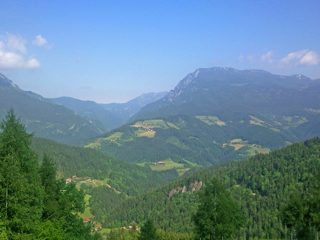
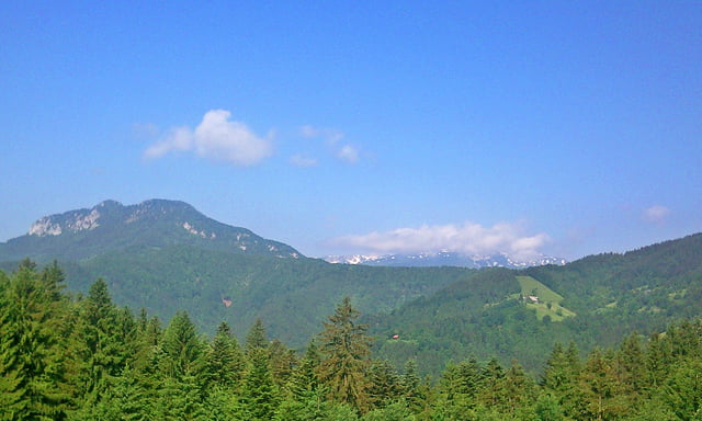
Izhodišče je pod Radmirsko zakladnico, pot pa poteka po asfaltu, nato večinoma po makedamskih poteh in proti vrhu postreže s čudovitimi razgledi nad Raduho, Olševo in Savinjskimi alpami.

Tour gallery

Tour map and elevation profile

  • Open Street Map
  • Google
Minimum height 388 m Maximum height 1057 m Detailed view

More about the tour author

katurocman
Member since 2008

Send private message

Comments

GPS tracks

Trackpoints
  • GPX / Garmin Map Source (gpx) download
  • TCX / Garmin Training Center® (tcx) download
  • CRS / Garmin Training Center® (crs) download
  • Google Earth (kml) download
  • G7ToWin (g7t) download
  • TTQV (trk) download
  • Overlay (ovl) download
  • Fugawi (txt) download
  • Kompass (DAV) Track (tk) download
  • Track data sheet (pdf) download
  • Original file of the author (gpx) download

More about the tour author

katurocman
Member since 2008

Send private message
Share track
Add to my favorites
Remove from my favorites
Edit tags
My score
Rate
Track: Radmirje-Gornji Grad-Savinjski vrh-Ljubno
Type: Mountain bike
Distance: 34,6 km
Evaluated on:
Duration:
Day(s)
Hour(s)
Minute(s)
Score: Landscape Fun factor Fitness Technique