


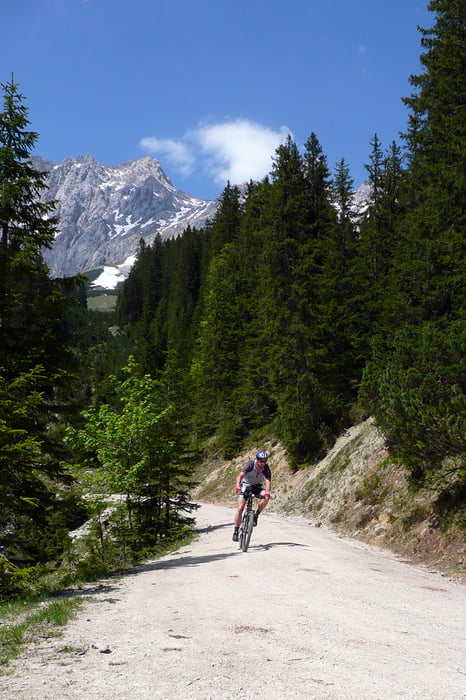
Runde um das Wettersteinmassiv mit Start/Ziel am Skistadion in Partenkirchen.
Partenkirchen -> Grainau -> Eibsee -> Höchthörlehütte (war übrigens zu) -> Ehrwald -> Ehrwalder Alm -> Gaistal -> Leutaschtal -> Mittenwald -> Ferchensee -> Elmau -> Eckbauer -> Partnachklamm
Die Auffahrt auf die Ehrwalder Alm (15% auf einigen Kilometern) und der Schlussanstieg zum Eckbauer (ein Stück über 20%) hat's in sich, wenn man nicht schieben will.
Der Pfad vom Eckbauer zur Partnachklamm, am Ende der Tour, ist ebenfalls ein kleines anspruchsvolleres Highlight gewesen (steil).
Wir sind die Tour zu dritt am 23. Mai 2009, bei herrlichem Wetter, gefahren.
Länge: 80km
Gesamtzeit / Fahrzeit: 9h 20min / 6h 5min
Gesamtschnitt / Fahrschnitt: 8,6 km/h / 13,2 km/h
Highspeed: 72 km/h
Höhenmeter (bergauf): 2240m
max. Höhe: 1637m. ü. NN
Further information at
http://www.ipernity.com/doc/nib/album/127722/showTour gallery
Tour map and elevation profile
Minimum height 606 m
Maximum height 1637 m
More about the tour author
|
|
nib |
Comments

Anfahrt erfolgte mit dem Auto. Parkmöglichkeiten am Skistadion Partenkirchen.
GPS tracks
Trackpoints-
GPX / Garmin Map Source (gpx) download
-
TCX / Garmin Training Center® (tcx) download
-
CRS / Garmin Training Center® (crs) download
-
Google Earth (kml) download
-
G7ToWin (g7t) download
-
TTQV (trk) download
-
Overlay (ovl) download
-
Fugawi (txt) download
-
Kompass (DAV) Track (tk) download
-
Track data sheet (pdf) download
-
Original file of the author (gpx) download
More about the tour author
|
|
nib |
Add to my favorites
Remove from my favorites
Edit tags
Open track
My score
Rate