


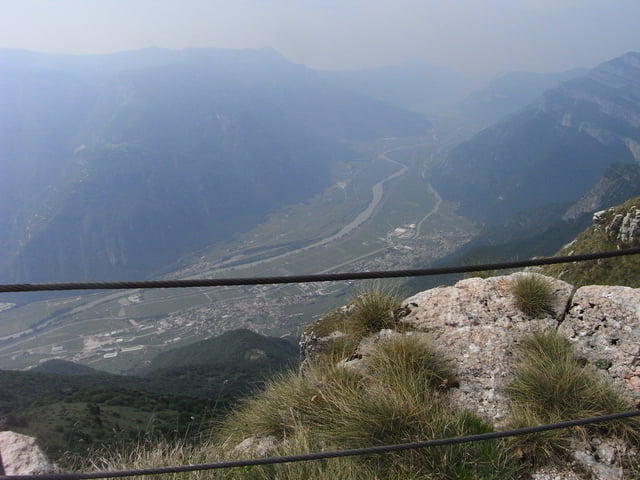
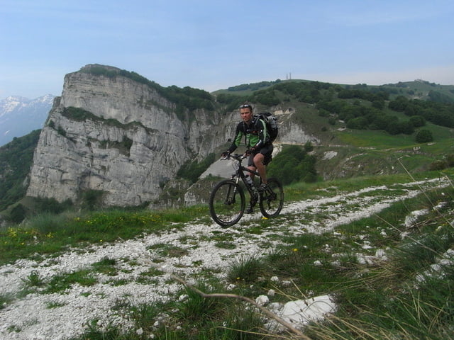
Die Tour über den Corno della Paura ist nicht extrem anspruchsvoll aber dafür sehr nett. Da der 601er vom Altissimo immer noch unter Schnee lag hab ich mir als highlight die Abfahrt vom Dos Remit über den "skull" ausgesucht .. weitere infos unter http://traube-online.net/tourDB/MTB_121_Corno_della_Paura.html
Further information at
http://www.tourdb.info/tourdb/detail/mtb/121/corno-della-paura-ueber-dem-etschtal.htmlTour gallery
Tour map and elevation profile
Minimum height 83 m
Maximum height 1655 m
More about the tour author
|
|
tintin |
Comments

GPS tracks
Trackpoints-
GPX / Garmin Map Source (gpx) download
-
TCX / Garmin Training Center® (tcx) download
-
CRS / Garmin Training Center® (crs) download
-
Google Earth (kml) download
-
G7ToWin (g7t) download
-
TTQV (trk) download
-
Overlay (ovl) download
-
Fugawi (txt) download
-
Kompass (DAV) Track (tk) download
-
Track data sheet (pdf) download
-
Original file of the author (gpx) download
More about the tour author
|
|
tintin |
Add to my favorites
Remove from my favorites
Edit tags
Open track
My score
Rate