Login

Forgot your login?

Cookies have to be accepted!
Your browser's cookie functionality is disabled. Please enable this functionality.

Not a member yet?

Register now
Login

Available for registred users only

Log in to use this feature.

Forgot your login?

Cookies have to be accepted!
Your browser's cookie functionality is disabled. Please enable this functionality.

Not a member yet?

Register now
Filter
Categories
Advanced filters
  • Distance (km)
  • Height
Save filters Reset filter

TrackRank

QRCode

Technical data

Distance63,5 km Height896 m Way down907 m Duration03:45 h:m Date18.09.2003
Scores Author Landscape Fun factor Fitness Technique

Statistics

3263 Views 1 Score 334 Downloads 1.00 Average
Rate
  • Track data sheet
  • Directions
  • Downloads
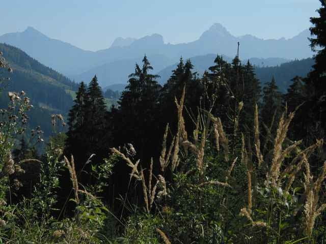
Eine verhältnismäßig einfach zu fahrende Runde, die vorallem durch ihre landschaftlichen Reize überzeugt. Start und Ziel in Reichraming. Erster Gipfel ist die Mooshöhe, wo es auch eine Raststation gibt. Hier heißt es dann umdrehen und ein Stück hinunterfahren. Sodann erklimmt man den Hirschkogelsattel und fährt zur Anlauf-Alm hinauf. Grandiose Fernblicke sind bei entsprechender Witterung garantiert!

Tour gallery

Tour map and elevation profile

  • Open Street Map
  • Google
Minimum height 349 m Maximum height 984 m Detailed view

More about the tour author

rjkas
Member since 2003

Send private message

Comments

GPS tracks

Trackpoints
  • GPX / Garmin Map Source (gpx) download
  • TCX / Garmin Training Center® (tcx) download
  • CRS / Garmin Training Center® (crs) download
  • Google Earth (kml) download
  • G7ToWin (g7t) download
  • TTQV (trk) download
  • Overlay (ovl) download
  • Fugawi (txt) download
  • Kompass (DAV) Track (tk) download
  • Track data sheet (pdf) download
  • Original file of the author (g7t) download

More about the tour author

rjkas
Member since 2003

Send private message
Share track
Add to my favorites
Remove from my favorites
Edit tags
My score
Rate
Track: Mooshöhe, Anlaufalm
Type: Mountain bike
Distance: 63,5 km
Evaluated on:
Duration:
Day(s)
Hour(s)
Minute(s)
Score: Landscape Fun factor Fitness Technique