


Gestartet wird am Wander - Parkplatz.
Ein Stück Teerrstraße, dann bald Waldweg.
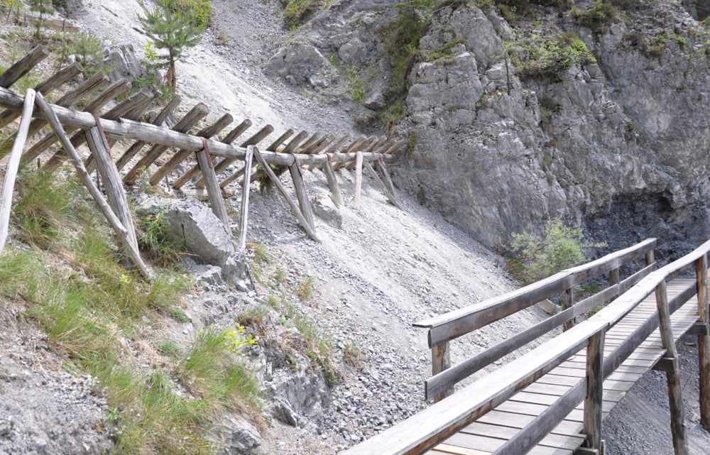
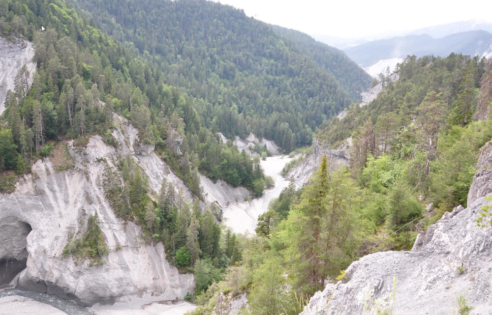
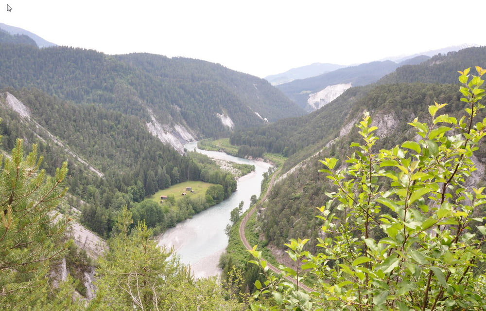
Es gibt komischerweise keine Wegweiser zu diesem tollen Pfad, der sich dann am Hang mit Ausblicken auf den Rhein auftut.
Am Ende kommt noch eine Fahrt den Tobel hinab. An der Versamer Brücke dann noch in den Rhein geschaut und die Teerstraße zurück. Auf der letzten Anhöhe geht links der MTB - Weg weg (06/2009 Baustelle und kaum zu sehen).
Dann kommt noch ein wenig Trail, bis man zurück auf dem Parkplatz ist.
Kurze schöne Runde, zum Teil ausgesetzt, aber immer über 50 cm breit.
Ein Stück Teerrstraße, dann bald Waldweg.
Es gibt komischerweise keine Wegweiser zu diesem tollen Pfad, der sich dann am Hang mit Ausblicken auf den Rhein auftut.
Am Ende kommt noch eine Fahrt den Tobel hinab. An der Versamer Brücke dann noch in den Rhein geschaut und die Teerstraße zurück. Auf der letzten Anhöhe geht links der MTB - Weg weg (06/2009 Baustelle und kaum zu sehen).
Dann kommt noch ein wenig Trail, bis man zurück auf dem Parkplatz ist.
Kurze schöne Runde, zum Teil ausgesetzt, aber immer über 50 cm breit.
Tour gallery
Tour map and elevation profile
Minimum height 648 m
Maximum height 908 m
More about the tour author
|
|
RandB |
Comments

GPS tracks
Trackpoints-
GPX / Garmin Map Source (gpx) download
-
TCX / Garmin Training Center® (tcx) download
-
CRS / Garmin Training Center® (crs) download
-
Google Earth (kml) download
-
G7ToWin (g7t) download
-
TTQV (trk) download
-
Overlay (ovl) download
-
Fugawi (txt) download
-
Kompass (DAV) Track (tk) download
-
Track data sheet (pdf) download
-
Original file of the author (gpx) download
More about the tour author
|
|
RandB |
Add to my favorites
Remove from my favorites
Edit tags
Open track
My score
Rate