


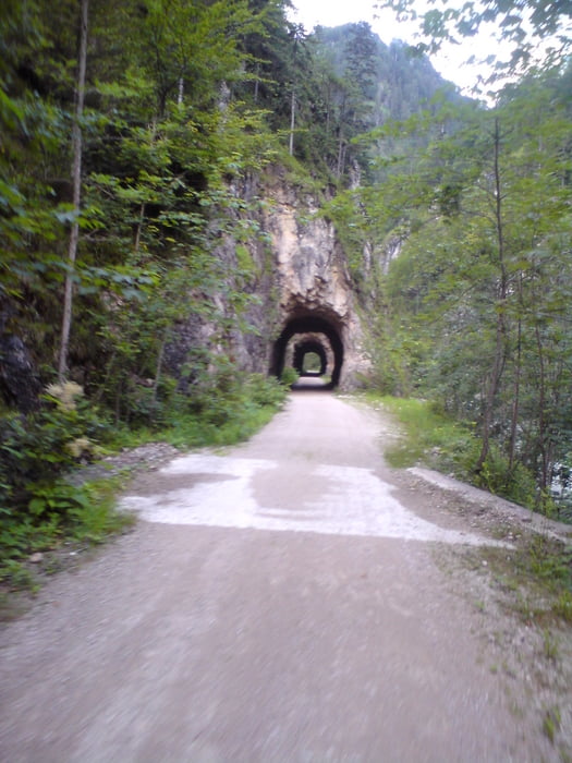
Diese Tour führt in das schöne Steyrtal auf die Anlaufalm. Parkmöglichekiten gibt es am Taleingang genügend. Von dort geht es gemächlich bergauf, kurzes Asphaltstueck, und dann gehts rauf auf die Alm. Erwin und Helga bieten auch Übernachtungsmöglichkeiten an, aber bitte unbedingt vorher reservieren (www.anlaufalm.at od 0664-4430141). Gutes Pappi und Aussicht geniessen, bevor es dann mit vollem Magen hinunter zum Reichramingbach geht und seinen 17? Tunnelabschnitte. Echt witzig zu fahren, geht auch ohne Taschenlampe;-)
Viel Spass dabei!!
Tour gallery
Tour map and elevation profile
Minimum height 389 m
Maximum height 984 m
More about the tour author
|
|
rabsi |
Comments

Reichraming Zentrum, weiter Richtung Brunnbach -Dimbach, dann einen gebührenpflichtigen Parkplatz nehmen.
GPS tracks
Trackpoints-
GPX / Garmin Map Source (gpx) download
-
TCX / Garmin Training Center® (tcx) download
-
CRS / Garmin Training Center® (crs) download
-
Google Earth (kml) download
-
G7ToWin (g7t) download
-
TTQV (trk) download
-
Overlay (ovl) download
-
Fugawi (txt) download
-
Kompass (DAV) Track (tk) download
-
Track data sheet (pdf) download
-
Original file of the author (gpx) download
More about the tour author
|
|
rabsi |
Add to my favorites
Remove from my favorites
Edit tags
Open track
My score
Rate