


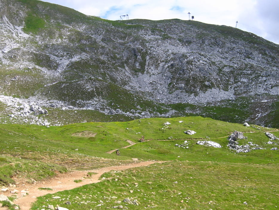
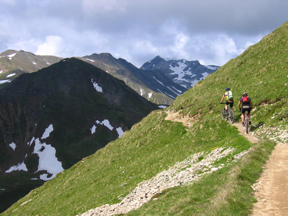
Mit der Parsennbahn aufs Weissfluhjoch. auf Skipisten hinunter zum Panoramaweg. Auf diesem traumhaften Trail bei super Aussicht zum Strelapass und weiter zur Latschüelfurgga. Dann super Trail hinunter nach Davos.
Im Tal auf gemischten Wegen (Teer, Schotter, Trail) weiter bis Monstein. Von hier sehr steile Auffahrt (25%+) hinauf zur Hauderalp. Auf sehr langem Trail immer am Hang entlang zur Bergstation der Rinerhornbahn und weiter bis Sertig Sand. auf der anderen Talseite über Trails und Schotterwege zurück nach Davos.
Bei Übernachtung in Davos ist die Bahn umsonst. Nur das Bike kostet 5 Fränkli.
Die Tour kann auch in Klosters mit der Gotschnagratbahn gestartet werden. Von der Bergstation immer dem Panoramaweg folgen, dann trifft man auf den Weg, der vom Weissfluhjoch herunterkommt. ( siehe auch Tour #39053 Lenzerheide-Davos).
Further information at
http://www.davos.chTour gallery
Tour map and elevation profile
Minimum height 1526 m
Maximum height 2659 m
More about the tour author

|
uwehai |
Comments

Start an der Talstation der Parsennbahn im Ortszentrum von Davos.
GPS tracks
Trackpoints-
GPX / Garmin Map Source (gpx) download
-
TCX / Garmin Training Center® (tcx) download
-
CRS / Garmin Training Center® (crs) download
-
Google Earth (kml) download
-
G7ToWin (g7t) download
-
TTQV (trk) download
-
Overlay (ovl) download
-
Fugawi (txt) download
-
Kompass (DAV) Track (tk) download
-
Track data sheet (pdf) download
-
Original file of the author (gpx) download
More about the tour author
|
|
uwehai |
Add to my favorites
Remove from my favorites
Edit tags
Open track
My score
Rate