
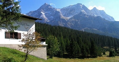

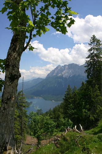
Einfahrrunde in der Zugspitzarena. Entweder in Ehrwald starten oder oben an der Talstation der Zugspitzbahn. Dann in Richtung Hochrührlhütte auf dem Aspahltweg. Der Einstieg ist zwar echt bissig, aber gut zu fahren. Oben an der Hütte im den Schilder der Thörle Runde folgen. Es lohnen wunderschöne Ausblicke auf Garmisch und den Eibsee. An der langen Abfahrt auf Schotter dann links wieder in Richtung Talstation. Die Tour ist insgesamt schattig und lohnt sich am ehesten bei warmen Wetter. Auch mit Familie zu fahren...dann aber im Einstieg schieben.
Viel Spaß.
Tour gallery
Tour map and elevation profile
Minimum height 1203 m
Maximum height 1538 m
More about the tour author
|
|
hellerich |
Comments

Von München nach Garmisch und Ehrwald.
Von Stuttgart über Füssen, Reutte nach Lermoos und Ehrwald.
Von Süden über den Fernpass, Biberwiehr nach Ehrwald.
GPS tracks
Trackpoints-
GPX / Garmin Map Source (gpx) download
-
TCX / Garmin Training Center® (tcx) download
-
CRS / Garmin Training Center® (crs) download
-
Google Earth (kml) download
-
G7ToWin (g7t) download
-
TTQV (trk) download
-
Overlay (ovl) download
-
Fugawi (txt) download
-
Kompass (DAV) Track (tk) download
-
Track data sheet (pdf) download
-
Original file of the author (gpx) download
More about the tour author
|
|
hellerich |
Add to my favorites
Remove from my favorites
Edit tags
Open track
My score
Rate