
")

Von Rottau aus ins Rottauer Tal. Immer Richtung Hochplatte haltend bis man unter dem Friedenrath (auf 1169m) wieder leicht bergab fährt. Die erste Abzweigung nach rechts oben (Hochplatte) liegen lassen. Nach ca. 400m geht in einer Kreuzung rechts bergauf der Gipfelweg (Hochplatte).
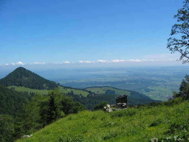
Erst kurz vor dem Gipfel wird der Blick auf das ganze Nordöstliche Alpenvorland frei. Am Gipfelpass kann man weiter zum Grassauer Haus (sehr serh gute Einkehr), muss aber diesen knappen Kilomter und die 100hm wieder zurück.
In diesem Bereich ein traumhafter Blick in alle Richtungen!
Fazit: Langweilige Auffahrt, Schöner Blick mit seltener Kulisse.
Further information at
http://www.martin-blum.de/bikeTour gallery
Tour map and elevation profile
Minimum height 549 m
Maximum height 1436 m
More about the tour author
|
|
martin.blum |
Comments
A8 München-Salzburg bis Ausfahrt BErnau. In Bernau geradeaus weiter Richtung Reit im Winkl. Erster Ort nach Bernau ist Rottau. Parken am Ortseingang rechts ("zum Adersberg")
GPS tracks
Trackpoints-
GPX / Garmin Map Source (gpx) download
-
TCX / Garmin Training Center® (tcx) download
-
CRS / Garmin Training Center® (crs) download
-
Google Earth (kml) download
-
G7ToWin (g7t) download
-
TTQV (trk) download
-
Overlay (ovl) download
-
Fugawi (txt) download
-
Kompass (DAV) Track (tk) download
-
Track data sheet (pdf) download
-
Original file of the author (gpx) download
More about the tour author
|
|
martin.blum |
Add to my favorites
Remove from my favorites
Edit tags
Open track
My score
Rate
Kondition