


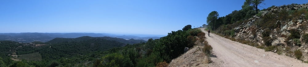
Langer und exponierter (heiß!) Anstieg über Asphalt und Forstwege zur Bergerie. Nette Ausblicke auf den Flughafen Figari und die Südküste. Für die nicht sooo Versierten (mich eingeschlossen) gibt es die empfehlenswerte Möglichkeit, den etwa 2 km langen und technischen Trail, der auf dem Rückweg nach der Abzweigung Richtung Poggiale kommt, wegzulassen und direkt wieder nach Vallicelo zurückzufahren. Passables Cafe in Figari.
Tour gallery
Tour map and elevation profile
Minimum height 42 m
Maximum height 895 m
More about the tour author
|
|
mackator |
Comments

Irgendwo am Straßenrand in Vallicelo
GPS tracks
Trackpoints-
GPX / Garmin Map Source (gpx) download
-
TCX / Garmin Training Center® (tcx) download
-
CRS / Garmin Training Center® (crs) download
-
Google Earth (kml) download
-
G7ToWin (g7t) download
-
TTQV (trk) download
-
Overlay (ovl) download
-
Fugawi (txt) download
-
Kompass (DAV) Track (tk) download
-
Track data sheet (pdf) download
-
Original file of the author (gpx) download
More about the tour author
|
|
mackator |
Add to my favorites
Remove from my favorites
Edit tags
Open track
My score
Rate