
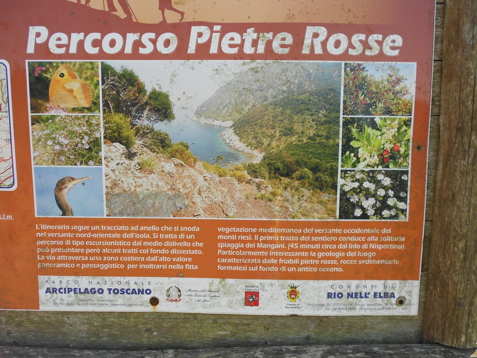

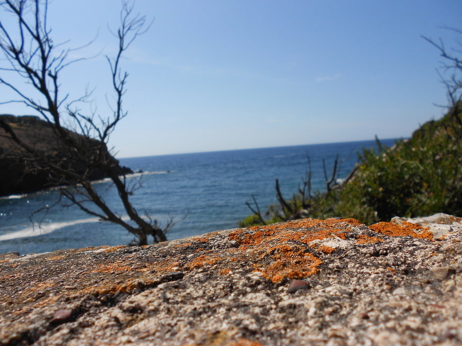
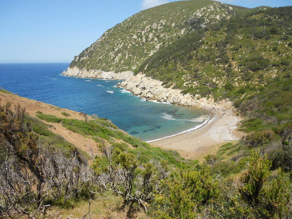
Il famoso percorso Pietre Rosse. Lasciata l'auto a Nisportino si attraversa la spiaggia e si risale per breve ma ripida salita sul versante opposto. Dopo breve traversata in cresta (percorso non sempre ben segnalato e/o evidente) si scende a cala dei Mangani. Splendida caletta spesso deserta anche in piena estate. Bagno.... ovviamente obbligatorio! Dopo la pausa si risale nuovamente per ripida salita che dopo un pò diventa meno impegnativa e all'ombra. Poco prima della strada asfaltata si tiene la destra e si segue la traccia GTE del sentiero 62 fino all'Aia di Cacio. Tratti molto panoramici. Pausa obbligatoria al tavolo con panchine e cartello illustrativo. Da qui per semplice ma ripida e ombreggiata sterrata si rientra al punto di partenza. Zona molto selvaggia, ancora allo stato naturale, a mio parere ingiustamente poco frequentata. Meglio cosi!
Further information at
http://www.islepark.it/visitare-il-parco/sentieri-pi%C3%B9-belli/597-elba-pietre-rosseTour gallery
Tour map and elevation profile
Minimum height 1 m
Maximum height 301 m
More about the tour author

|
mikyross |
Comments

italia toscana livorno isola d'elba rio nell'elba nisportino
GPS tracks
Trackpoints-
GPX / Garmin Map Source (gpx) download
-
TCX / Garmin Training Center® (tcx) download
-
CRS / Garmin Training Center® (crs) download
-
Google Earth (kml) download
-
G7ToWin (g7t) download
-
TTQV (trk) download
-
Overlay (ovl) download
-
Fugawi (txt) download
-
Kompass (DAV) Track (tk) download
-
Track data sheet (pdf) download
-
Original file of the author (gpx) download
More about the tour author
|
|
mikyross |
Add to my favorites
Remove from my favorites
Edit tags
Open track
My score
Rate