


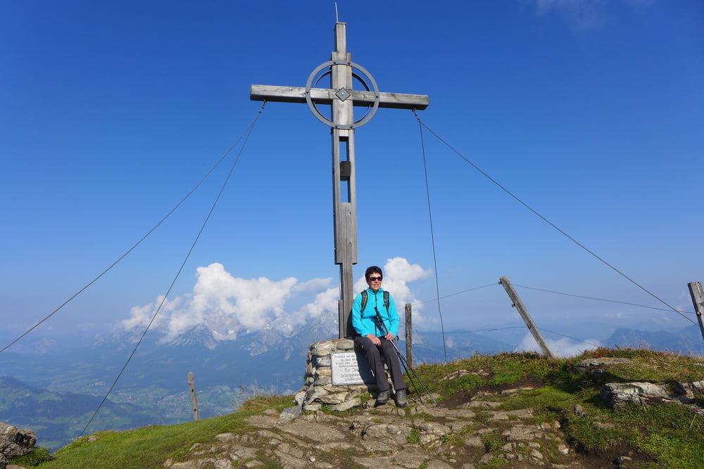
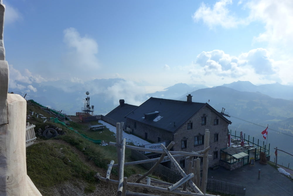
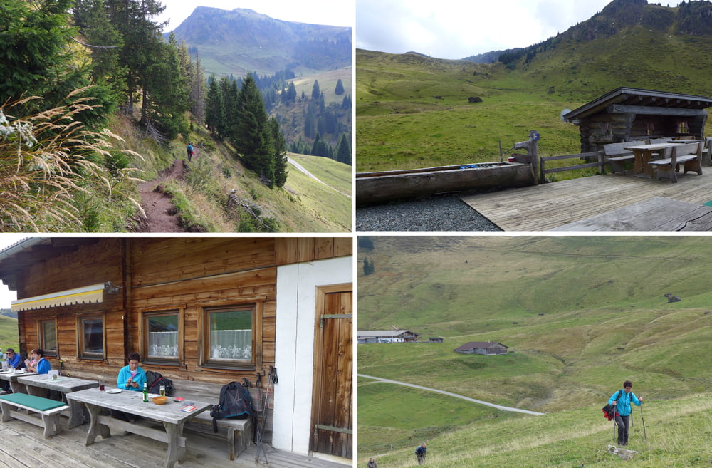
Die Runde haben wir im Kitztrail-Heft des Tourismusverbandes als „Kitztrail Kulinaria“ aufgeschnappt und etwas ins sportliche hin modifiziert. Zunächst sind wir mit der Hornbahn „nur“ bis zum Alpenhaus hinauf gefahren, haben uns dann mit ein paar Höhenmetern bis zum Kitzbüheler Horn Gipfelhaus akklimatisiert, sind anschließend zur Hornköpflhütte abgestiegen um letztendlich in der Lämmerbühelalm zu versacken. :-)
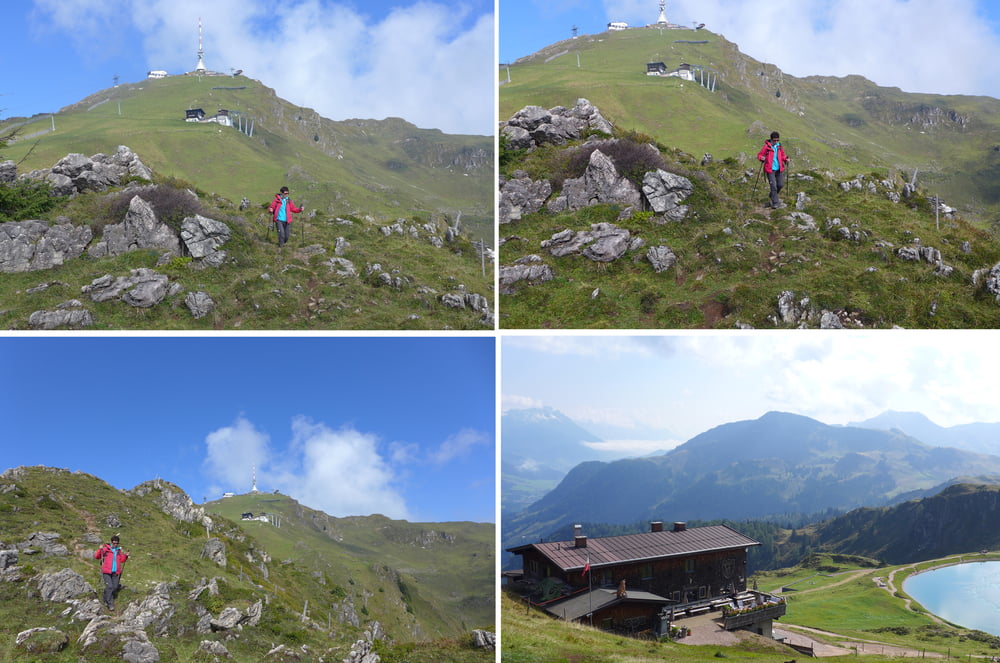
Da der Weg sehr viel über Skihänge verläuft, wird das Ganze mit einem sogenannten Karstweg etwas aufgepeppt. Zurück ging es dann wieder zum Alpenhaus und hinab mit der Hornbahn.
Wir sind übrigens am Appartmenthaus Elisabeth gestartet.
Da der Weg sehr viel über Skihänge verläuft, wird das Ganze mit einem sogenannten Karstweg etwas aufgepeppt. Zurück ging es dann wieder zum Alpenhaus und hinab mit der Hornbahn.
Wir sind übrigens am Appartmenthaus Elisabeth gestartet.
Further information at
https://www.kitzbuehel.com/Tour gallery
Tour map and elevation profile
Minimum height 1430 m
Maximum height 1994 m
More about the tour author
|
|
Saxoniaradler |
Comments

GPS tracks
Trackpoints-
GPX / Garmin Map Source (gpx) download
-
TCX / Garmin Training Center® (tcx) download
-
CRS / Garmin Training Center® (crs) download
-
Google Earth (kml) download
-
G7ToWin (g7t) download
-
TTQV (trk) download
-
Overlay (ovl) download
-
Fugawi (txt) download
-
Kompass (DAV) Track (tk) download
-
Track data sheet (pdf) download
-
Original file of the author (gpx) download
More about the tour author
|
|
Saxoniaradler |
Add to my favorites
Remove from my favorites
Edit tags
Open track
My score
Rate