


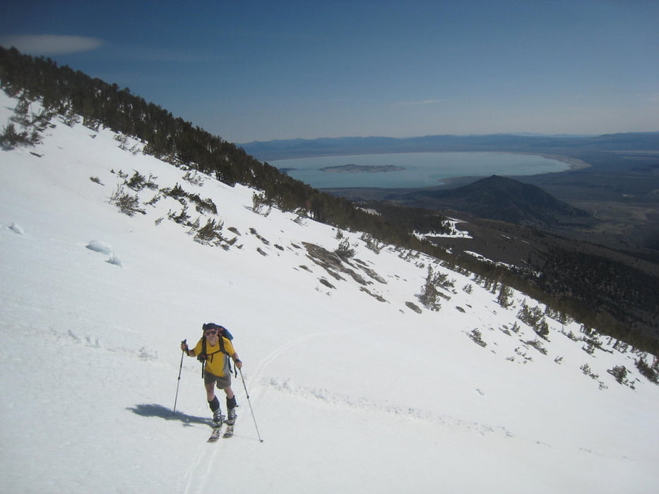
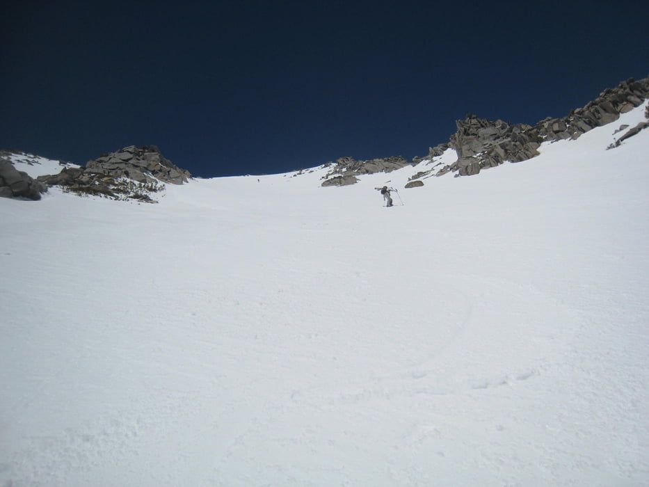
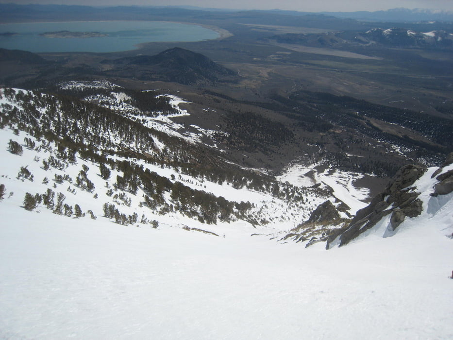
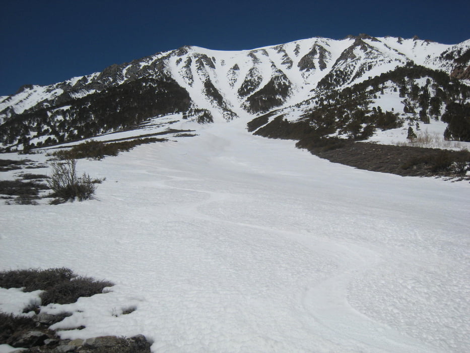
Zuerst der Forstraße folgen. Auf der großen Wiese nicht links über den Bach (wie unser Aufstiegs-track, sondern besser dem Abfahrts-track folgen) sondern weglos etwas rechts vom Bach weiter und in schmalen Waldgürtel den Bach überqueren und linkerhand eine Schneezunge erreichen. Von ihr der offensichtlichen Aufstiegslinie folgen. Wir wählten das mittlere Couloir, die anderen rechts und links dürften ähnlich sein. Oben links haltend zum Wintergipfel. Der tatsächliche Hauptgipfel liegt weiter SW und lohnt sich nicht mehr. Im N ist der Mt. Dana (schöner Anstieg von der Tioga pass road) zu sehen. Tolle lange und zügig steile Abfahrt. Unten leichtes Gelände das immer Besten Firn verspricht. Abfahrt folgt dem Aufstieg.
Tour gallery
Tour map and elevation profile
Minimum height 2298 m
Maximum height 3840 m
More about the tour author

|
Gi |
Comments

Von Mammoth US 395 nach Norden nehmen, 1.75mi nördlich von Hwy 158 links auf die Oilplant road abbiegen. Nach 1.3 miles rechts und weiteren 0.9 mi links abbiegen und der dirt road in den Bohler Canyon folgen. Hier stoppten uns umgefallene Bäume.
GPS tracks
Trackpoints-
GPX / Garmin Map Source (gpx) download
-
TCX / Garmin Training Center® (tcx) download
-
CRS / Garmin Training Center® (crs) download
-
Google Earth (kml) download
-
G7ToWin (g7t) download
-
TTQV (trk) download
-
Overlay (ovl) download
-
Fugawi (txt) download
-
Kompass (DAV) Track (tk) download
-
Track data sheet (pdf) download
-
Original file of the author (gpx) download
More about the tour author
|
|
Gi |
Add to my favorites
Remove from my favorites
Edit tags
Open track
My score
Rate