Login

Login vergessen?

Cookies müssen akzeptiert werden!
Die Cookie-Funktion Ihres Browsers ist deaktiviert. Bitte aktivieren Sie die Funktion.

Noch kein Mitglied?

Jetzt Registrieren
Login

Nur für eingeloggte Benutzer möglich

Melde dich an, um diese Funktion nutzen zu können.

Login vergessen?

Cookies müssen akzeptiert werden!
Die Cookie-Funktion Ihres Browsers ist deaktiviert. Bitte aktivieren Sie die Funktion.

Noch kein Mitglied?

Jetzt Registrieren
Filter
Kategorien
Erweiterte Filter
  • Länge (km)
  • Höhenmeter
Filter speichern Filter zurücksetzen

TrackRank

QRCode

Technische Daten

Länge73,9 km Höhenmeter1217 m Abstieg1204 m Dauer20:00 h:m Datum25.07.2007
Bewertungen Autor Landschaft Spaßfaktor Kondition Technik

Statistik

4526 Views Bewertungen 381 Downloads Durchschnitt
Bewerten
  • Tourenblatt
  • Anfahrt
  • Downloads
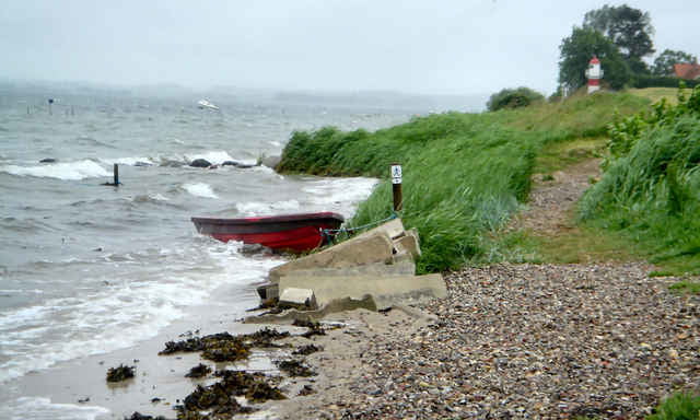
Gendarmstien is based on an old border patrol path that was used from 1920-1958. The trail begins in Padborg near the German/Danish border and ends in a small village on the island Als. The trail runs along the coast of southeastern Jutland and southern Als, but in some areas it swings into the countryside. It may be an advantage to study the Danish border history due to the many historical references along the trail, but the trail can also be enjoyed solely on its varied landscape and scenic views.
A 48 page leaflet with good maps is available from the tourist offices.

Weitere Informationen unter

http://www.sydjylland.com/index.lasso?page=324X4640

Tour Galerie

Tour Karte und Höhenprofil

  • Open Street Map
  • Google
Minimale Höhe -49 m Maximale Höhe 79 m Detailansicht

Mehr zum Tourautor

sba
Mitglied seit 2007

Land: Dänemark

1 erstellte Touren
9
Private Nachricht senden

Kommentare

The trail can be accessed from the main road no. 8. Look for road signs with a blue border patrol man next to the word "Gendarmstien". Many smaller roads lead directly to good parking and picnic areas, so you can easily plan your own part of the trail.

GPS-Tracks

Trackpunkte
  • GPX / Garmin Map Source (gpx) download
  • TCX / Garmin Training Center® (tcx) download
  • CRS / Garmin Training Center® (crs) download
  • Google Earth (kml) download
  • G7ToWin (g7t) download
  • TTQV (trk) download
  • Overlay (ovl) download
  • Fugawi (txt) download
  • Kompass (DAV) Track (tk) download
  • Tourenblatt (pdf) download
  • Originaldatei des Autors (gpx) download

Mehr zum Tourautor

sba
Mitglied seit 2007

Land: Dänemark

1 erstellte Touren
9
Private Nachricht senden
Tour teilen
Zu meinen Favoriten hinzufügen
Von meinen Favoriten entfernen
Tags bearbeiten
Meine Bewertung
Bewerten
Tour: Gendarmstien
Art: Wandern
Länge: 73,9 km
Bewertet am:
Dauer:
Tag(e)
Stunde(n)
Minute(n)
Bewertung: Landschaft Spaßfaktor Kondition Technik