Login

Forgot your login?

Cookies have to be accepted!
Your browser's cookie functionality is disabled. Please enable this functionality.

Not a member yet?

Register now
Login

Available for registred users only

Log in to use this feature.

Forgot your login?

Cookies have to be accepted!
Your browser's cookie functionality is disabled. Please enable this functionality.

Not a member yet?

Register now
Filter
Categories
Advanced filters
  • Distance (km)
  • Height
Save filters Reset filter

TrackRank

QRCode

Technical data

Distance6,9 km Height344 m Way down357 m Duration02:45 h:m Date16.05.2012
Scores Author User Landscape Fun factor Fitness Technique

Statistics

385 Views 1 Score 90 Downloads 2.00 Average
Rate
  • Track data sheet
  • Directions
  • Downloads
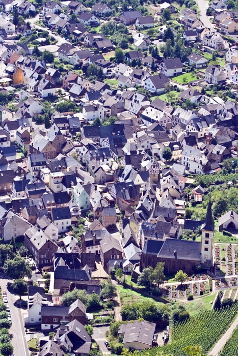
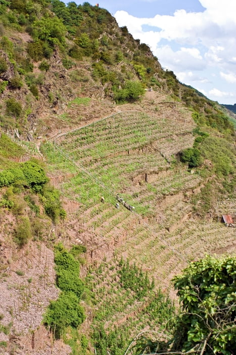
Die Tour beginnt auf einem normalen Wanderweg. Geht Steil in die Weinberge und wird zum schmalen Pfad. Der weitere Wegverlauf führt über schmale Wege, die gesichert sind und Metallleiter. Im Sommer kann es sehr warm werden. Kein Schatten auf der ganzen Tour. Der Calmont ist der steilste Weinberg von Europa.

Tour gallery

Tour map and elevation profile

  • Open Street Map
  • Google
Minimum height 93 m Maximum height 387 m Detailed view

More about the tour author

Rotpunkt
Member since 2009

Send private message

Comments

Mit dem Auto nach Bremm an der Mosel. Mit dem Zug bis Edinger-Eller von dort direkt zum Einstieg.

GPS tracks

Trackpoints
  • GPX / Garmin Map Source (gpx) download
  • TCX / Garmin Training Center® (tcx) download
  • CRS / Garmin Training Center® (crs) download
  • Google Earth (kml) download
  • G7ToWin (g7t) download
  • TTQV (trk) download
  • Overlay (ovl) download
  • Fugawi (txt) download
  • Kompass (DAV) Track (tk) download
  • Track data sheet (pdf) download
  • Original file of the author (gpx) download

More about the tour author

Rotpunkt
Member since 2009

Send private message
Share track
Add to my favorites
Remove from my favorites
Edit tags
My score
Rate
Track: Klettersteig Calmont
Type: Hiking
Distance: 6,9 km
Evaluated on:
Duration:
Day(s)
Hour(s)
Minute(s)
Score: Landscape Fun factor Fitness Technique