


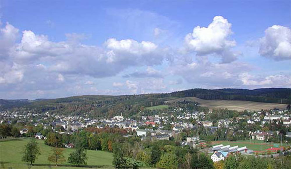
Mittelschwere und landschaftlich reizvolle Rundstrecke an den Hängen um die Stadt Olbernhau.
(60% Waldwege, 30% Asphalt, 5% Single-Trail, 5% öffentliche Strasse)
Für Geocacher dürfte die Runde besonders interessant sein, da unmittelbar an der Strecke 10 Caches gesucht, gefunden und geloggt werden können.
1. GC115AK - Gotteshäuser: Kirche Oberneuschönberg
2. GC25KNK - Ohau View - Kirchweg
3. GC1XREW - Alfons Diener von Schönberg (Multi)
4. GC24DR8 - Ohau View - Kretschmerhöhe
5. GC2Y69T - Kindheitserinnerungen - Spielplatz Buttermilch
6. GC28DHV - Ohau View - Weg nach Hutha
7. GC24DR0 - Ohau View - Neue Schänke
8.GC2Q6PW - Abenteuer Rungstocktal
9. GC24DR5 - Ohau View - Frankwarte
10. GC24D01 - Saigerhütte Grünthal (Multi)
Further information at
http://www.olbernhau.de/Tour gallery
Tour map and elevation profile
Minimum height 428 m
Maximum height 677 m
More about the tour author
|
|
joestreich |
Comments

Start- und Zielpunkt ist der kostenlose Parkplatz an der Diskothek "Halle".
GPS tracks
Trackpoints-
GPX / Garmin Map Source (gpx) download
-
TCX / Garmin Training Center® (tcx) download
-
CRS / Garmin Training Center® (crs) download
-
Google Earth (kml) download
-
G7ToWin (g7t) download
-
TTQV (trk) download
-
Overlay (ovl) download
-
Fugawi (txt) download
-
Kompass (DAV) Track (tk) download
-
Track data sheet (pdf) download
-
Original file of the author (gpx) download
More about the tour author
|
|
joestreich |
Add to my favorites
Remove from my favorites
Edit tags
Open track
My score
Rate