


Diese Wanderung ist leider nur möglich wenn man 2 PKW zur Verfügung hat, der Aufwand lohnt sich aber.
Man startet bei der Grießneralm und marschiert wie hunderte andere auch auf einem breiten, steilen Trampelpfad bis zur Stripsenjochhütte. Ab hier wird es bei dieser Wanderung jedoch einsam (ausser man will über den Stripsenkopf zur Feldalm, nicht in den Karten eingezeichnet aber möglich!).
Weiter geht es über Feldalmsattel zur Hochalm (Einkehr möglich), beide Punkte sind wir jedoch geringfügig umgangen um einen Kuh-Hund Konflikt zu vermeiden ;)
Von der Hochalm geht es weiter zur Kleinmoosenalm und weiter entlang den Hängen des Zahmen Kaisers zur Gwirchtalm.
Ab dort in Richtung NW entlang des Erzbaches ins Tal. Zum Schluss haben wir mangels Markierung die Abkürzung zum Parkplatz übersehen, sind über Forstweg und Wiese hinunter.
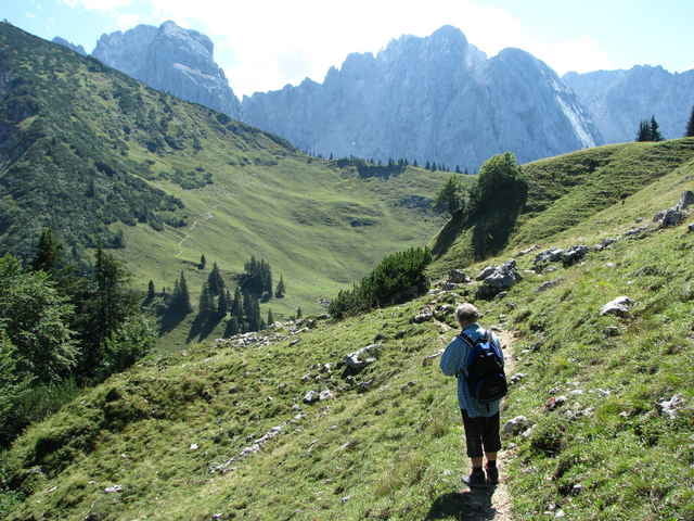
Tour gallery
Tour map and elevation profile
Minimum height 764 m
Maximum height 1605 m
More about the tour author

|
guenther.rupitz |
Comments

Mit dem Auto über St. Johann/Tirol oder Kössen ins Kaiserbachtal. Über die Mautstraße (2007: 2,5€/PKW, ab 18 Uhr kostenlos) bis zur Grießneralm.
Das zweite auto beim WP "Parkplatz 2" in Walchsee stehen lassen.
Das zweite auto beim WP "Parkplatz 2" in Walchsee stehen lassen.
GPS tracks
Trackpoints-
GPX / Garmin Map Source (gpx) download
-
TCX / Garmin Training Center® (tcx) download
-
CRS / Garmin Training Center® (crs) download
-
Google Earth (kml) download
-
G7ToWin (g7t) download
-
TTQV (trk) download
-
Overlay (ovl) download
-
Fugawi (txt) download
-
Kompass (DAV) Track (tk) download
-
Track data sheet (pdf) download
-
Original file of the author (gpx) download
More about the tour author
|
|
guenther.rupitz |
Add to my favorites
Remove from my favorites
Edit tags
Open track
My score
Rate