


Another shuttle...
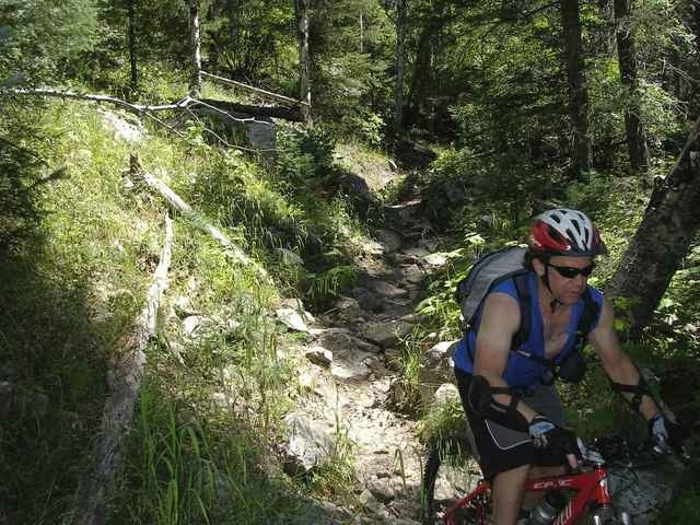
Steep, rocky and a few waterfalls to drop. One of the best trails in Santa Fe and excellent for days when the lower elevations are baking.
Steep, rocky and a few waterfalls to drop. One of the best trails in Santa Fe and excellent for days when the lower elevations are baking.
Further information at
http://www.fs.fed.us/r3/sfe/recreation/districts/espanola/trails/163_rioenmedio.htmlTour gallery
Tour map and elevation profile
Minimum height 2156 m
Maximum height 3175 m
More about the tour author

|
notaknob |
Comments

Leave a shuttle vehicle in Rio en Medio. Drive another vehicle up Pacheco Canyon Rd (FR 102 from the village of Rio en Medio). This makes for a shorter climb on fireroads leaving more energy for singletrack. Climb Pacheco Canyon rd to the Santa Fe Ski Resort Rd, hwy 475. Follow paved rd to overlook and get on Winsor trail. You can also stay on paved road till you get to the ski resort. Cross the small bridge to the north bank of the Rio en Medio from the trailhead at the lower end of the parking lot and turn left, following the Rio en Medio downstream.
GPS tracks
Trackpoints-
GPX / Garmin Map Source (gpx) download
-
TCX / Garmin Training Center® (tcx) download
-
CRS / Garmin Training Center® (crs) download
-
Google Earth (kml) download
-
G7ToWin (g7t) download
-
TTQV (trk) download
-
Overlay (ovl) download
-
Fugawi (txt) download
-
Kompass (DAV) Track (tk) download
-
Track data sheet (pdf) download
-
Original file of the author (gpx) download
More about the tour author
|
|
notaknob |
Add to my favorites
Remove from my favorites
Edit tags
Open track
My score
Rate