Login

Forgot your login?

Cookies have to be accepted!
Your browser's cookie functionality is disabled. Please enable this functionality.

Not a member yet?

Register now
Login

Available for registred users only

Log in to use this feature.

Forgot your login?

Cookies have to be accepted!
Your browser's cookie functionality is disabled. Please enable this functionality.

Not a member yet?

Register now
Filter
Categories
Advanced filters
  • Distance (km)
  • Height
Save filters Reset filter

TrackRank

QRCode

Technical data

Distance38,1 km Height1497 m Way down1523 m Duration05:20 h:m Date21.08.2007
Scores Author User Landscape Fun factor Fitness Technique

Statistics

1938 Views 3 Scores 584 Downloads 3.33 Average
Rate
  • Track data sheet
  • Directions
  • Downloads
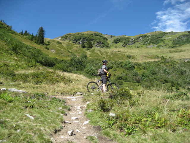
Sehr nette, aber auch anspruchsvolle Tour mit 2 harten Anstiegen. Die Landschaft ist unbeschreiblich ...
Dies ist eine Kombi aus der Schreiene Brunnen Tour mit Kohlmaisrunde. Zuerst fährt man S-B und ab Spielberghaus dann Kohlmais.
Man fährt kaum Asphalt, aber traumhafte Single-Trails.

Tour gallery

Tour map and elevation profile

  • Open Street Map
  • Google
Minimum height 866 m Maximum height 1633 m Detailed view

More about the tour author

sappok
Member since 2007

Send private message

Comments

Cube_Rider on 25.09.2008

Feedback

Eine der schönsten Touren, die ich bis jetzt gefahren habe. Anstrengend, traumhafte Landschaft, super Single-Trails. Diese Tour macht von Anfang bis zum Ende einfach Spaß.

Danke, ich muss da auch unbedingt mal wieder hin
RudolfTill on 10.11.2011

Bewertung

Schöne Tour die wir am 5.11.2011 nachgefahren sind. Allerdings war der Trailanteil geringer und die Auffahrten weniger anstrengend als beschrieben. Als Bewertung für den Spaßfaktor und die Kondition sollten maximal 3 Sterne vergeben werden, da es im Pinzgau viele tolle Trails gibt. So kann man bsw. von der Panoramaalm weiter auf dem Höhenweg zum Asitz und von dort die Trails zum Bikepark Leogang hinunterfahren.
Wir sind ab Hinterglemm (am Bike Hotel Toni) gestartet. Ist aber im Prinzip gleichgültig.
In Hinterglemm Richtung Talschluss und beim Forellenhof dann rechts hoch.

GPS tracks

Trackpoints
  • GPX / Garmin Map Source (gpx) download
  • TCX / Garmin Training Center® (tcx) download
  • CRS / Garmin Training Center® (crs) download
  • Google Earth (kml) download
  • G7ToWin (g7t) download
  • TTQV (trk) download
  • Overlay (ovl) download
  • Fugawi (txt) download
  • Kompass (DAV) Track (tk) download
  • Track data sheet (pdf) download
  • Original file of the author (gpx) download

More about the tour author

sappok
Member since 2007

Send private message
Share track
Add to my favorites
Remove from my favorites
Edit tags
My score
Rate
Track: Kombi aus Schreiende Brunnen und Kohlmaisrunde
Type: Mountain bike
Distance: 38,1 km
Evaluated on:
Duration:
Day(s)
Hour(s)
Minute(s)
Score: Landscape Fun factor Fitness Technique