


Sehr schöne Tour den Kohlmaiskopf hoch. Das sind erst mal 500 HM am Stück. Das kann weh tun.
Danach ist aber alles super.
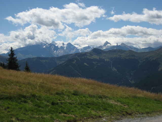
Wunderschöne Panoramaausblicke und traumhafte single-trails.
Wir sind bis zur Alten Schmiede, hier gibts günstig Spagetti.
Dann noch mal 150 HM rauf und anschließend nur bergab.
Wer tehnisch gut drauf ist, sollte rechts den Single-Trail zur Hecherhütte abfahren.
Für diejenigen, die Schotter runter fahren, ist zum Schluss eine Asphaltstrecke, die gerne 70 km/h zulässt. Ist auch nett.
Dann noch ein schönes Cool-Down (10km, 200HM) nach Hinterglemm
Danach ist aber alles super.
Wunderschöne Panoramaausblicke und traumhafte single-trails.
Wir sind bis zur Alten Schmiede, hier gibts günstig Spagetti.
Dann noch mal 150 HM rauf und anschließend nur bergab.
Wer tehnisch gut drauf ist, sollte rechts den Single-Trail zur Hecherhütte abfahren.
Für diejenigen, die Schotter runter fahren, ist zum Schluss eine Asphaltstrecke, die gerne 70 km/h zulässt. Ist auch nett.
Dann noch ein schönes Cool-Down (10km, 200HM) nach Hinterglemm
Tour gallery
Tour map and elevation profile
Minimum height 846 m
Maximum height 1878 m
More about the tour author
|
|
sappok |
Comments

Alles geht in Saalbach los.
GPS tracks
Trackpoints-
GPX / Garmin Map Source (gpx) download
-
TCX / Garmin Training Center® (tcx) download
-
CRS / Garmin Training Center® (crs) download
-
Google Earth (kml) download
-
G7ToWin (g7t) download
-
TTQV (trk) download
-
Overlay (ovl) download
-
Fugawi (txt) download
-
Kompass (DAV) Track (tk) download
-
Track data sheet (pdf) download
-
Original file of the author (gpx) download
More about the tour author
|
|
sappok |
Add to my favorites
Remove from my favorites
Edit tags
Open track
My score
Rate