


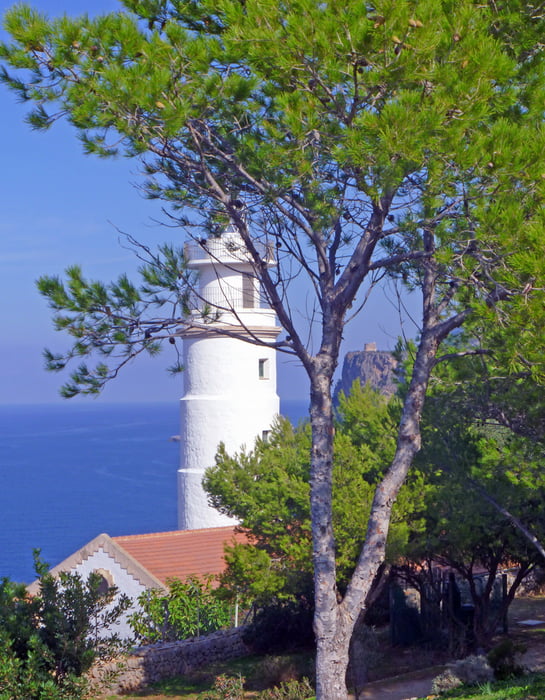
Der erste Teil der Rundwanderung entspricht dem des Rundwegs 1 (siehe Tour #102747), verlässt aber irgendwann den Weg Richtung Deià nach rechts zum Refugi de Moleta am Cap Gros mit seinem weißen Leuchtturm und dann hinunter zum Port de Sóller. Von dort entspricht der Rückweg dem Hinweg.
Alternativ dazu kann man aber auch mit der einzigen Straßenbahn Mallorcas durch Orangen- und Zitronengärten nach Sóller zurückfahren.
Tour gallery


Tour map and elevation profile
Minimum height -5 m
Maximum height 195 m
More about the tour author
|
|
hadihe |
Comments

Von Palma kommend liegt zur Rechten an der MA 11 der Botanische Garten von Sóller. Auf dessen Höhe finden sich immer Parkmöglichkeiten beidseitig der MA 11.
GPS tracks
Trackpoints-
GPX / Garmin Map Source (gpx) download
-
TCX / Garmin Training Center® (tcx) download
-
CRS / Garmin Training Center® (crs) download
-
Google Earth (kml) download
-
G7ToWin (g7t) download
-
TTQV (trk) download
-
Overlay (ovl) download
-
Fugawi (txt) download
-
Kompass (DAV) Track (tk) download
-
Track data sheet (pdf) download
-
Original file of the author (gpx) download
More about the tour author
|
|
hadihe |
Add to my favorites
Remove from my favorites
Edit tags
Open track
My score
Rate