


Start der Tour ist die Kultur- und Sporthalle in Theley.
Die Fahrt führt uns Richtung Seelbach,Peterberg, Braunshausen vorbei am Bostalsee ( nur in der Ferne ), Gonnesweiler, Gronig zurück nach Theley.
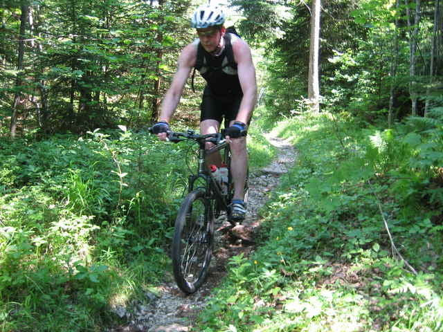
Zwischendurch werden Schotter-, Wald-, Wiesen- und befestigte Wege befahren. Auch für die Singeltrailfahrer ist etwas dabei ( Bergauf wie Bergab )
Im großenund ganzen eine schöne Tour durch das nördliche Saarland.
Die Fahrt führt uns Richtung Seelbach,Peterberg, Braunshausen vorbei am Bostalsee ( nur in der Ferne ), Gonnesweiler, Gronig zurück nach Theley.
Zwischendurch werden Schotter-, Wald-, Wiesen- und befestigte Wege befahren. Auch für die Singeltrailfahrer ist etwas dabei ( Bergauf wie Bergab )
Im großenund ganzen eine schöne Tour durch das nördliche Saarland.
Tour gallery
Tour map and elevation profile
Minimum height 339 m
Maximum height 575 m
More about the tour author
|
|
adi2307 |
Comments

Über die A1 Abfahrt Tholey, Richtund Sotzweiler,Tholey dann Theley. In der Ortsmitte gehts dann zur Kultur- und Sporthalle.
GPS tracks
Trackpoints-
GPX / Garmin Map Source (gpx) download
-
TCX / Garmin Training Center® (tcx) download
-
CRS / Garmin Training Center® (crs) download
-
Google Earth (kml) download
-
G7ToWin (g7t) download
-
TTQV (trk) download
-
Overlay (ovl) download
-
Fugawi (txt) download
-
Kompass (DAV) Track (tk) download
-
Track data sheet (pdf) download
-
Original file of the author (gpx) download
More about the tour author
|
|
adi2307 |
Add to my favorites
Remove from my favorites
Edit tags
Open track
My score
Rate