


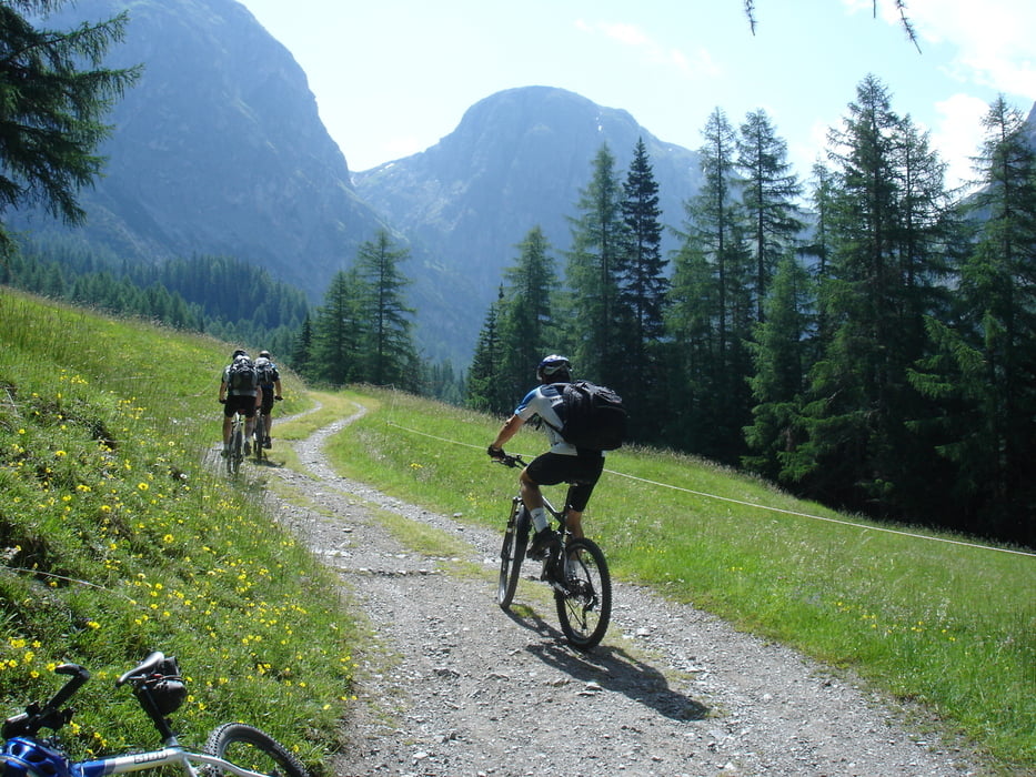
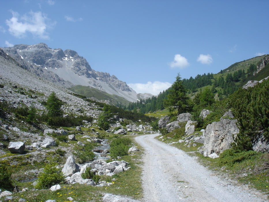
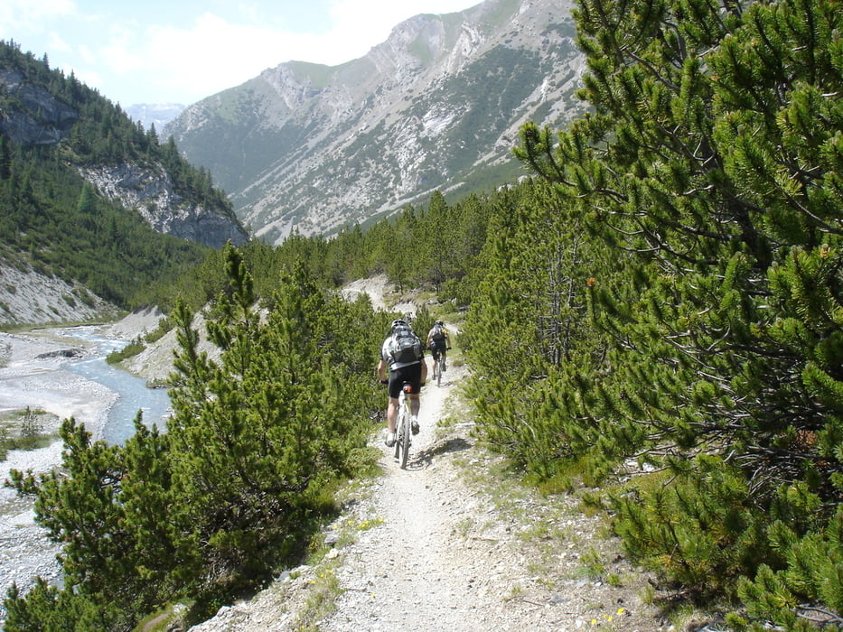
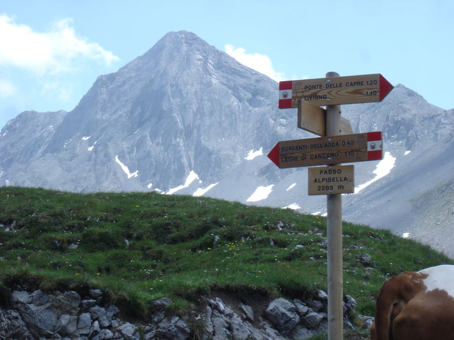
Start from campground in Scuol and ride to Sur-En. Enter Uina valley and climb to Uina gorge and further to Sesvenna pass and Sesvenna alpine hut. Descend to Laatsch and follow the road to Taufers. Spend 1st night in Gasthof Avinga (45 Euro, dinner included). Leave Avinga early morning to Sta.Maria and do a left turn climbing up to Val Mora (one of the most beautiful valleys in the Alps). Ride down to Lago di San Giacomo. Take another climb to the Alpisella pass followed by a fast downhill to Livigno lake. 2nd night in Livigno at the Astra hotel enjoying their sauna. Leave Livigno at 8 am riding to Fedaria valley. Make a right turn at the sign saying Passo Di Cassana (old guys had to push most of the steep trail to the pass). Push and carry bikes on the other side of the pass downhill for 30 minutes and enjoy the trail down to Zernez. Ride until Lavin and take the Inn Bike Trail uphill to Guarda. Follow the paved road to Ardez and take the main road for a few kilometers getting back to Scuol campground.
Tour gallery
Tour map and elevation profile
Minimum height 476 m
Maximum height 2686 m
More about the tour author

|
racklj |
Comments

GPS tracks
Trackpoints-
GPX / Garmin Map Source (gpx) download
-
TCX / Garmin Training Center® (tcx) download
-
CRS / Garmin Training Center® (crs) download
-
Google Earth (kml) download
-
G7ToWin (g7t) download
-
TTQV (trk) download
-
Overlay (ovl) download
-
Fugawi (txt) download
-
Kompass (DAV) Track (tk) download
-
Track data sheet (pdf) download
-
Original file of the author (gpx) download
More about the tour author
|
|
racklj |
Add to my favorites
Remove from my favorites
Edit tags
Open track
My score
Rate