


Rundwanderung im Waldgelände überwiegend auf (Forst)- Straßen und Waldwegen.
Vom Parkplatz Oberschieda an der Staatsstraße 2177 von Schwarzenbach an der Saale nach Kirchenlamitz der weiß-blauen Markierung folgend zum Schluß weglos auf den "Gipfel" des Kleinen Kornbergs.
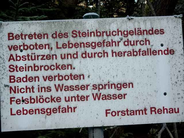
Vom höchsten Punkt zuerst auf einer Holzrückegasse, dann weglos zum oberen Rand des Granitsteinbruchs mit kleinem See (Achtung Absturzgefahr).
Im Sommer würde der romantische See zu einem Bad einladen - allerdings - (siehe Bild 2).
Vom Steinbruch zurück auf die Forststraße und dem Track folgend immer im Hochwald rund um den Kleinen Kornberg.
Auf dem letzten Stück des Weges öffnet sich rechts der Waldrand und gibt den Blick auf Oberschieda und Richtung Schwarzenbach/S. frei.
Am Waldrand entlang zurück zum Parkplatz.
Vom Parkplatz Oberschieda an der Staatsstraße 2177 von Schwarzenbach an der Saale nach Kirchenlamitz der weiß-blauen Markierung folgend zum Schluß weglos auf den "Gipfel" des Kleinen Kornbergs.
Vom höchsten Punkt zuerst auf einer Holzrückegasse, dann weglos zum oberen Rand des Granitsteinbruchs mit kleinem See (Achtung Absturzgefahr).
Im Sommer würde der romantische See zu einem Bad einladen - allerdings - (siehe Bild 2).
Vom Steinbruch zurück auf die Forststraße und dem Track folgend immer im Hochwald rund um den Kleinen Kornberg.
Auf dem letzten Stück des Weges öffnet sich rechts der Waldrand und gibt den Blick auf Oberschieda und Richtung Schwarzenbach/S. frei.
Am Waldrand entlang zurück zum Parkplatz.
Further information at
http://www.international-goods.com/archiv/k/kleiner_kornberg.htmTour gallery
Tour map and elevation profile
Minimum height 547 m
Maximum height 667 m
More about the tour author
|
|
KaufensH |
Comments

Auf der Staatsstraße 2177 von Kirchenlamitz oder Schwarzenbach an der Saale zum Wanderparkplatz bei Oberschieda.
GPS tracks
Trackpoints-
GPX / Garmin Map Source (gpx) download
-
TCX / Garmin Training Center® (tcx) download
-
CRS / Garmin Training Center® (crs) download
-
Google Earth (kml) download
-
G7ToWin (g7t) download
-
TTQV (trk) download
-
Overlay (ovl) download
-
Fugawi (txt) download
-
Kompass (DAV) Track (tk) download
-
Track data sheet (pdf) download
More about the tour author
|
|
KaufensH |
Add to my favorites
Remove from my favorites
Edit tags
Open track
My score
Rate