Login

Forgotten password?

Cookies have to be accepted!
Your browser's cookie functionality is disabled. Please enable this functionality.

Not a member yet?

Register now
Login

Available for registred users only

Log in to use this feature.

Forgotten password?

Cookies have to be accepted!
Your browser's cookie functionality is disabled. Please enable this functionality.

Not a member yet?

Register now
Filter
Categories
Advanced filters
  • Distance (km)
  • Height
Save filters Reset filter

TrackRank

QRCode

Technical data

Distance63,3 km Height976 m Way down985 m Duration05:04 h:m Date10.07.2012
Scores Author Landscape Fun factor Fitness Technique

Statistics

41 Views Scores 3 Downloads Average
Rate
  • Track data sheet
  • Directions
  • Downloads

Kolis, Kajoš, Krutov, Major a já - čistá Zombie práce

Zpátky jsem jel sám -  z Kružberka před barák - 30km za 1:28 h - nahoře na kraji lesa 20min
poprvé jsem dal ten potok na singlíku po odbočce před mostkem, za hodinu jsem lezl přes  Štáblovický potok u soutoku s Hvozdnici a kusek chybělo vyjel bych i tam to asíčko plné listí...

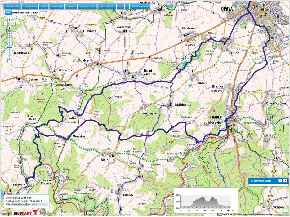
Tour map and elevation profile

  • Open Street Map
  • Google
Minimum height 231 m Maximum height 560 m Detailed view

More about the tour author

mtbBen
Member since 2011

Send private message

Comments

GPS tracks

Trackpoints
  • GPX / Garmin Map Source (gpx) download
  • TCX / Garmin Training Center® (tcx) download
  • CRS / Garmin Training Center® (crs) download
  • Google Earth (kml) download
  • G7ToWin (g7t) download
  • TTQV (trk) download
  • Overlay (ovl) download
  • Fugawi (txt) download
  • Kompass (DAV) Track (tk) download
  • Track data sheet (pdf) download
  • Original file of the author (gpx) download

More about the tour author

mtbBen
Member since 2011

Send private message
Share track
Add to my favorites
Remove from my favorites
Edit tags
My score
Rate
Track: 20120708 Kružberk
Type: Mountain bike
Distance: 63,3 km
Evaluated on:
Duration:
Day(s)
Hour(s)
Minute(s)
Score: Landscape Fun factor Fitness Technique