****Ausrüstung****
Rad: MTB (CarbonR., FullXTR)
Tracking: Nokia6680 + irgendein GPS-Empfänger
##################
****Kurzinfo: Kurz, sehr dreckig, teilweise reguläre Strecke, aber sehr witzig****
****Tour****
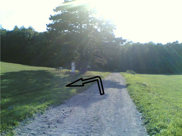
PerchtoldsdorferHeide rauf, immer der Schotterstraße folgen. Nach der Salzstangerlhütte kommt irgendwann auf der linken Seite so ein kleiner MarienPfeiler und eine Landkarte. (siehe Bild)
Dort wenden und der Radroute folgen, welche im Wald endet. Der Weg teilt sich dann unmittelbar nach der Waldeinfahrt, ich bin den linken "Weg" gefahren. Das ist dann keine Strecke mehr,...wen man glaubt man ist garantiert falsch: weiterfahren, es macht bombenspaß und irgendwann kommt dann auch wieder eine Waldstraße.
Am Ende dann rechts fahren. Nach etwa 1km bergab kommt eine Abzweigung, welche man Richtung P*dorf nimmt. Im Verlauf fährt man dann an einem Bauernhof vorbei und kommt in P*dorf Ortsteil Tirolerhof raus. (Herlicher Blick über Wien)
Straßenverlauf Richtung P*dorfer Hauptplatz folgen.
LgP
Further information at
http://members.aon.at/wienerhuette/Tour map and elevation profile
Minimum height 161 m
Maximum height 564 m
Comments

PerchtoldsdorferHeide (Rad)
oder Liesinger Hauptbahnhof (S-Bahn, Bus)
oder Liesinger Hauptbahnhof (S-Bahn, Bus)
GPS tracks
Trackpoints-
GPX / Garmin Map Source (gpx) download
-
TCX / Garmin Training Center® (tcx) download
-
CRS / Garmin Training Center® (crs) download
-
Google Earth (kml) download
-
G7ToWin (g7t) download
-
TTQV (trk) download
-
Overlay (ovl) download
-
Fugawi (txt) download
-
Kompass (DAV) Track (tk) download
-
Track data sheet (pdf) download
-
Original file of the author (g7t) download
Add to my favorites
Remove from my favorites
Edit tags
Open track
My score
Rate


