


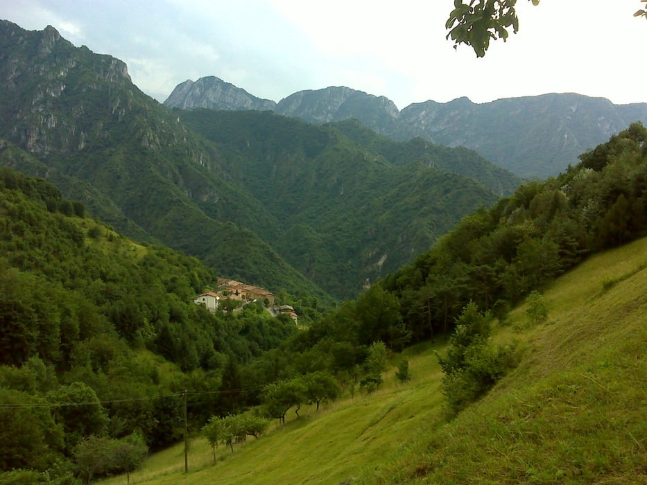
Anspruchsvolle Rundtour mit einem einsamen Aufstieg über Eno zum Passo Cavallino und einer rasanten Abfahrt zum Gardasee.
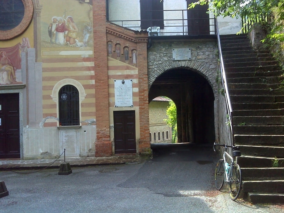
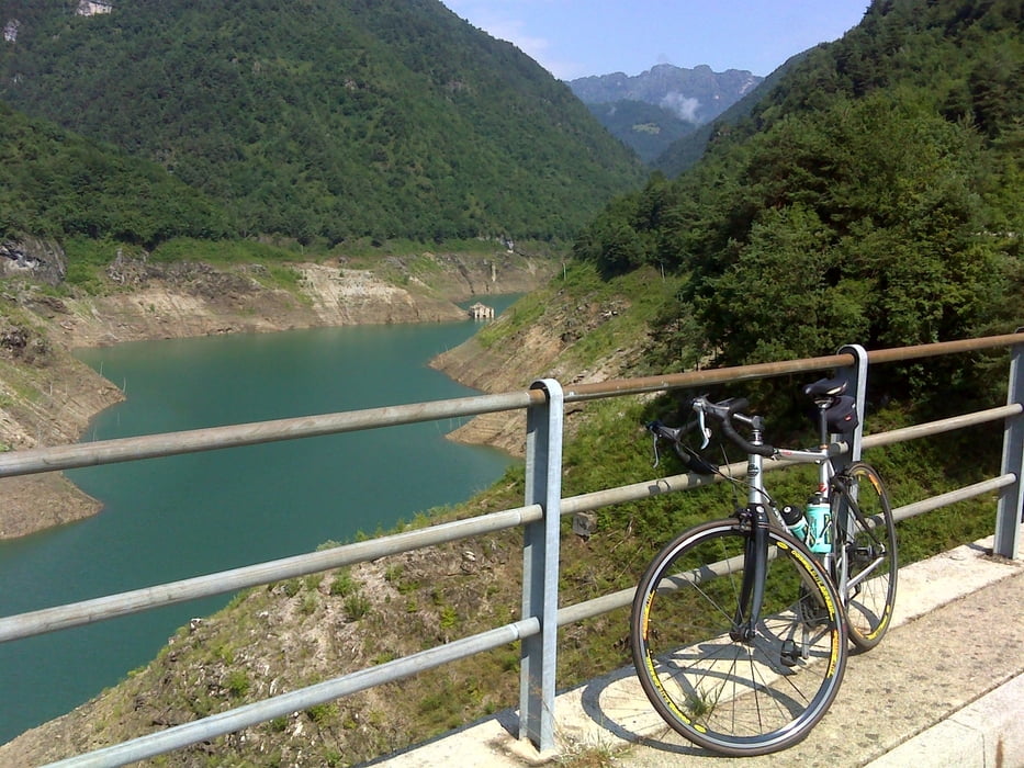
Der Abzweig in Vorbano in Richtung Eno ist leicht zu übersehen, dann geht es auf eine schmalen Straße relativ einsam hoch zum Pass. Die Abfahrt führt zunächst steil bergab (mit "Durchfahrt" durch eine Art Kirche) und weiter steil bis zum Abzweig wo man links zum Idrosee fahren könnte, ich aber "rechts" zum Lago die Valvestino. Dann noch mal kurz bergauf um dann eine wunderschöne Abfahrt zunächst am Lago die Valvestino und dann rasant hinunter zum Gardasee.
Bis zum Gardasee war die Strecke relativ wenig befahren, aber am Gardasee lang bis nach Salo dann doch stärker, was aber nicht so sehr störte, da man relativ zügig unterwegs ist.
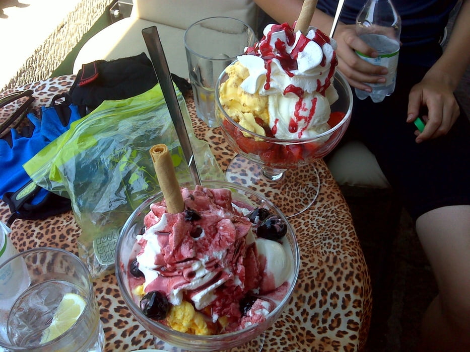
Von Salo nach Moniga ist die Straße wieder eher mäßig befahren und in Manerba del Garda kann man noch ein wunderbares Eis mit einer schönen Aussicht genießen...
Tour gallery
Tour map and elevation profile
Minimum height 71 m
Maximum height 1082 m
More about the tour author
|
|
thomi64 |
Comments

GPS tracks
Trackpoints-
GPX / Garmin Map Source (gpx) download
-
TCX / Garmin Training Center® (tcx) download
-
CRS / Garmin Training Center® (crs) download
-
Google Earth (kml) download
-
G7ToWin (g7t) download
-
TTQV (trk) download
-
Overlay (ovl) download
-
Fugawi (txt) download
-
Kompass (DAV) Track (tk) download
-
Track data sheet (pdf) download
-
Original file of the author (gpx) download
More about the tour author
|
|
thomi64 |
Add to my favorites
Remove from my favorites
Edit tags
Open track
My score
Rate