

Einrollrunde von Porto Azzurro aus. KM stimmen aber nicht! Sind etwa 20km!
Übernachtig wie ich war, hab ich zwei Touren am GPS drauf gehabt und gemeinsam gespeichert... Leider weiss ich nicht, wie man die wieder trennt, also:
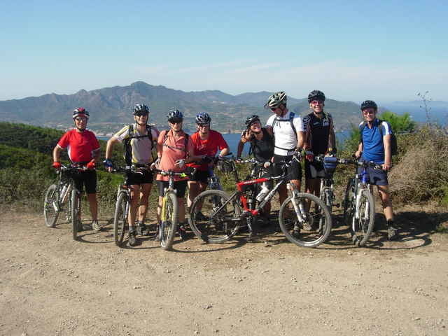
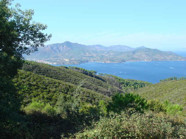
Die Tour ist nur das, was von Porto Azzurro nach SÜDEN weist und wieder nach Capoliveri und zurück nach Porto Azzurro geht.
Capoliveri, schöne Stadt am Berg, und dann ein erstes Hineinschnuppern in die Trails und Wege der Insel. Gleich nach Capoliveri beginnt eine Panorama-Forstraße. Steile Schotterrampen und ein flowiger Schlangenweg wieder hinunter zum Meer sind die Highlights dieser Tour. Nicht wundern über den Track: Wir sind kreuz und quer durch den Wald und über den Mte. Calamita. Den "Schlangenweg" haben wir erst beim zweiten Anlauf gefunden....:))). Das Gebiet am Mte. Calamita bietet sicher noch viele viele Schmankerl...
Übernachtig wie ich war, hab ich zwei Touren am GPS drauf gehabt und gemeinsam gespeichert... Leider weiss ich nicht, wie man die wieder trennt, also:
Die Tour ist nur das, was von Porto Azzurro nach SÜDEN weist und wieder nach Capoliveri und zurück nach Porto Azzurro geht.
Capoliveri, schöne Stadt am Berg, und dann ein erstes Hineinschnuppern in die Trails und Wege der Insel. Gleich nach Capoliveri beginnt eine Panorama-Forstraße. Steile Schotterrampen und ein flowiger Schlangenweg wieder hinunter zum Meer sind die Highlights dieser Tour. Nicht wundern über den Track: Wir sind kreuz und quer durch den Wald und über den Mte. Calamita. Den "Schlangenweg" haben wir erst beim zweiten Anlauf gefunden....:))). Das Gebiet am Mte. Calamita bietet sicher noch viele viele Schmankerl...
Tour gallery
Tour map and elevation profile
Minimum height -1 m
Maximum height 506 m
More about the tour author

|
NoDoc |
Comments

GPS tracks
Trackpoints-
GPX / Garmin Map Source (gpx) download
-
TCX / Garmin Training Center® (tcx) download
-
CRS / Garmin Training Center® (crs) download
-
Google Earth (kml) download
-
G7ToWin (g7t) download
-
TTQV (trk) download
-
Overlay (ovl) download
-
Fugawi (txt) download
-
Kompass (DAV) Track (tk) download
-
Track data sheet (pdf) download
-
Original file of the author (gpx) download
More about the tour author
|
|
NoDoc |
Add to my favorites
Remove from my favorites
Edit tags
Open track
My score
Rate