


Schöne Alpenländische Tagestour
Die Tour startet in Frauenfeld und geht zum rascheren Vorankommen auf die Autobahn A1. Bis zur Ausfahrt Gossau. Von dort aus nach Appenzell und dann Richtung Oberriet. Nach rund 1½ Stunden Fahrt erreicht man den Landgasthof Hölzlisberg von dem aus man einen wunderbaren Ausblick auf das Rheintal hat.
Nach einer weiteren Stunde Fahrt kommt man zum Furkajoch. Lassen Sie sich nicht von der billigen Pommes Bude auf dem Joch blenden, denn nur wenige Kilometer weiter unten findet man den Geheimtipp Alpengasthof Jägerstüble. Es lohnt sich, dort auf die Terrasse zu sitzen.
Die nächste Etappe dauert rund 1½ Stunden und führt zum Bauerngasthof Cafe Mayr, wo es Kuchen und Kaffee gibt. Man kann dort aber auch herzhaft essen.
Die Rückfahrt von dort dauert 2½ Stunden. Ein möglicher Halt ist sicher noch Sulzberg. Dort gibt es eine wunderbare Aussicht.
Als letzte Etappe habe ich die Autobahn gewählt. Damit ist man schnell wieder in Frauenfeld.
Further information at
http://www.alpentourer.de/alpenpaesse/region1/furkajoch/furkajoch.htmlTour gallery
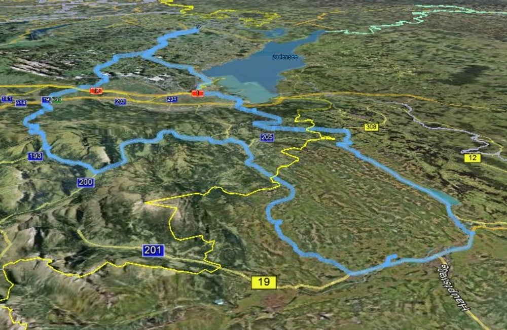
Tour map and elevation profile
Minimum height 377 m
Maximum height 1756 m
More about the tour author

|
jardne |
Comments

Anfahrt nach Frauenfeld über die Autobahn A7 oder Tourstart auf der Autobahn A1 direkt bei der Abfahrt Gossau.
GPS tracks
Trackpoints-
GPX / Garmin Map Source (gpx) download
-
TCX / Garmin Training Center® (tcx) download
-
CRS / Garmin Training Center® (crs) download
-
Google Earth (kml) download
-
G7ToWin (g7t) download
-
TTQV (trk) download
-
Overlay (ovl) download
-
Fugawi (txt) download
-
Kompass (DAV) Track (tk) download
-
Track data sheet (pdf) download
-
Original file of the author (gpx) download
More about the tour author
|
|
jardne |
Add to my favorites
Remove from my favorites
Edit tags
Open track
My score
Rate