


Tourendatum: 07.09.2012
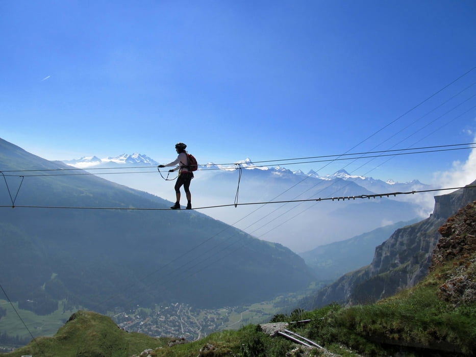
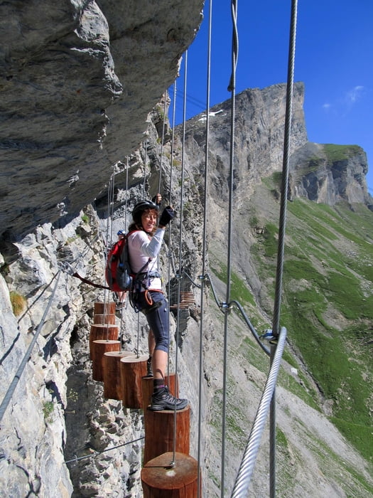
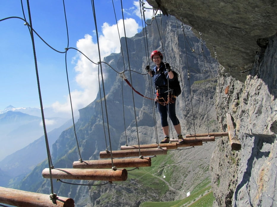
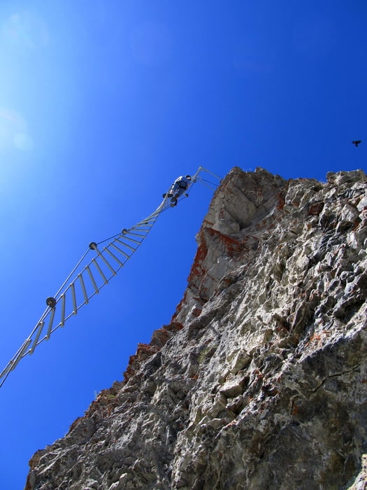
Tourencharakter: Neuer Erlebnisklettersteig in der Wand unterhalb der Bergstation der Gemmi-Seilbahn. Zum Einstieg ab der Bergstation in 5 Min. (beim alten Wildstrubelhotel).
Der Klettersteig beinhaltet Elemente eines Seilparks z.B. Drahtseilbrücken, Holzbalkenbrücken, Drahtnetz, Spiralförmige Drahtseilleiter etc. Schwindelfreiheit ist unerlässlich.
Der Steig verläuft in leichtem Auf (ca. 100Hm) und Ab entlang der Wand und endet wieder in der Nähe der Bergstation.
Schwierigkeit: KS4 bzw. D
Die Ausblicke ins Tal und auf die Walliser Gletscherberge sind atemberaubend.
Abfahrt entweder mit der Seilbahn oder Abstieg über den beeindruckenden Gemmi-Steig nach Leukerbad in knapp 1,5h.
Picasa-Foto-Link zum Kopieren:
https://picasaweb.google.com/101543947384755168643/KSTGemmi070912
Further information at
http://www.leukerbad.gmxhome.de/Tour gallery
Tour map and elevation profile
Minimum height 1385 m
Maximum height 2365 m
More about the tour author
|
|
Eimy |
Comments

Von Susten (ca. 10km östlich von Sierre) über Leuk hinauf nach Leukerbad (ca.1400m) - In Leukerbad links haltend hinauf zum Parkplatz der Gemmibahn.
GPS tracks
Trackpoints-
GPX / Garmin Map Source (gpx) download
-
TCX / Garmin Training Center® (tcx) download
-
CRS / Garmin Training Center® (crs) download
-
Google Earth (kml) download
-
G7ToWin (g7t) download
-
TTQV (trk) download
-
Overlay (ovl) download
-
Fugawi (txt) download
-
Kompass (DAV) Track (tk) download
-
Track data sheet (pdf) download
-
Original file of the author (gpx) download
More about the tour author
|
|
Eimy |
Add to my favorites
Remove from my favorites
Edit tags
Open track
My score
Rate