Login

Forgot your login?

Cookies have to be accepted!
Your browser's cookie functionality is disabled. Please enable this functionality.

Not a member yet?

Register now
Login

Available for registred users only

Log in to use this feature.

Forgot your login?

Cookies have to be accepted!
Your browser's cookie functionality is disabled. Please enable this functionality.

Not a member yet?

Register now
Filter
Categories
Advanced filters
  • Distance (km)
  • Height
Save filters Reset filter

TrackRank

QRCode

Technical data

Distance23,9 km Height1634 m Way down1636 m Duration04:00 h:m Date13.09.2012
Scores Author User Landscape Fun factor Fitness Technique

Statistics

1001 Views 1 Score 87 Downloads 5.00 Average
Rate
  • Track data sheet
  • Directions
  • Downloads

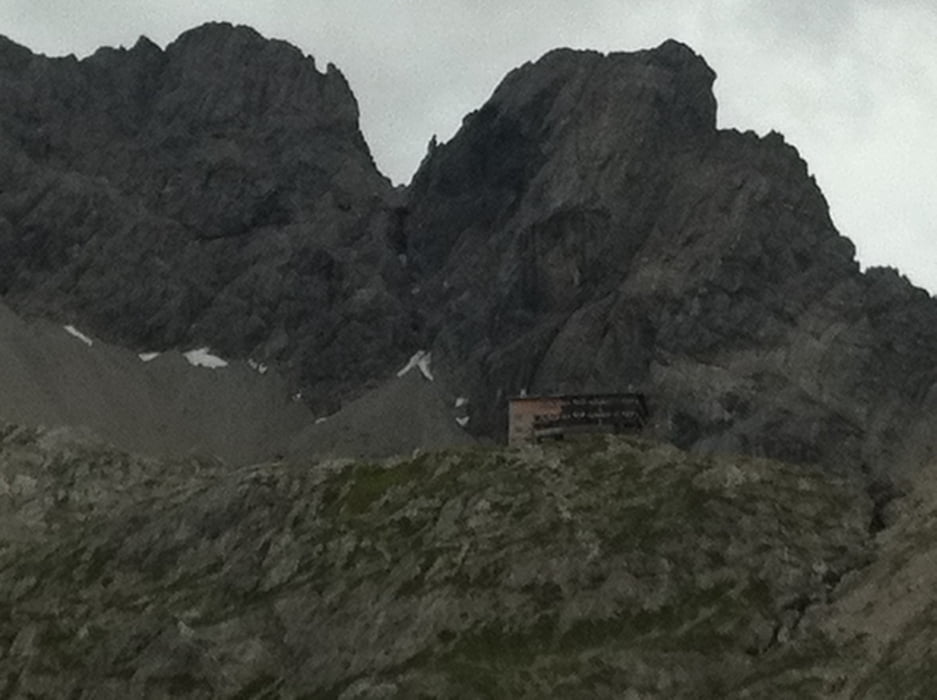
Eine anstrengende, aber landschaftlich sehr empfehlenswerte MTB-Tour in Osttirol. Tourstart ist der Tristacher See in der Nähe von Lienz, von hier gehts zunächst über eine Bergstraße bis zur Mautstelle beim Kreithof und weiter bis zur Dolomitenhütte. Über einen groben Schotterweg weiter bis zur spektakulär gelegenen Karlsbaderhütte inmitten der Lienzer Dolomiten.

Rückweg wie Hinweg.


Tour gallery

Tour map and elevation profile

  • Open Street Map
  • Google
Minimum height 815 m Maximum height 2258 m Detailed view

More about the tour author

rushy
Member since 2008

Send private message

Comments

Von Lienz nach Tristach zum Tristacher Seee

GPS tracks

Trackpoints
  • GPX / Garmin Map Source (gpx) download
  • TCX / Garmin Training Center® (tcx) download
  • CRS / Garmin Training Center® (crs) download
  • Google Earth (kml) download
  • G7ToWin (g7t) download
  • TTQV (trk) download
  • Overlay (ovl) download
  • Fugawi (txt) download
  • Kompass (DAV) Track (tk) download
  • Track data sheet (pdf) download
  • Original file of the author (gpx) download

More about the tour author

rushy
Member since 2008

Send private message
Share track
Add to my favorites
Remove from my favorites
Edit tags
My score
Rate
Track: Karlsbader Hütte
Type: Mountain bike
Distance: 23,9 km
Evaluated on:
Duration:
Day(s)
Hour(s)
Minute(s)
Score: Landscape Fun factor Fitness Technique