Login

Forgotten password?

Cookies have to be accepted!
Your browser's cookie functionality is disabled. Please enable this functionality.

Not a member yet?

Register now
Login

Available for registred users only

Log in to use this feature.

Forgotten password?

Cookies have to be accepted!
Your browser's cookie functionality is disabled. Please enable this functionality.

Not a member yet?

Register now
Filter
Categories
Advanced filters
  • Distance (km)
  • Height
Save filters Reset filter

TrackRank

QRCode

Technical data

Distance8,4 km Height757 m Way down739 m Duration00:00 h:m Date14.09.2012
Scores Author Landscape Fun factor Fitness Technique

Statistics

627 Views Scores 63 Downloads Average
Rate
  • Track data sheet
  • Directions
  • Downloads


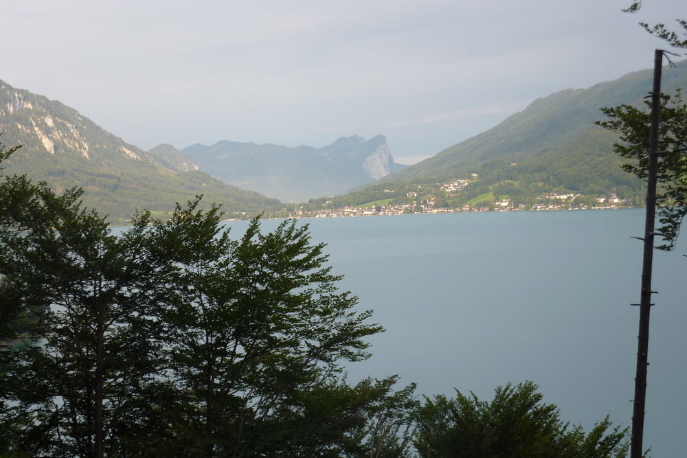
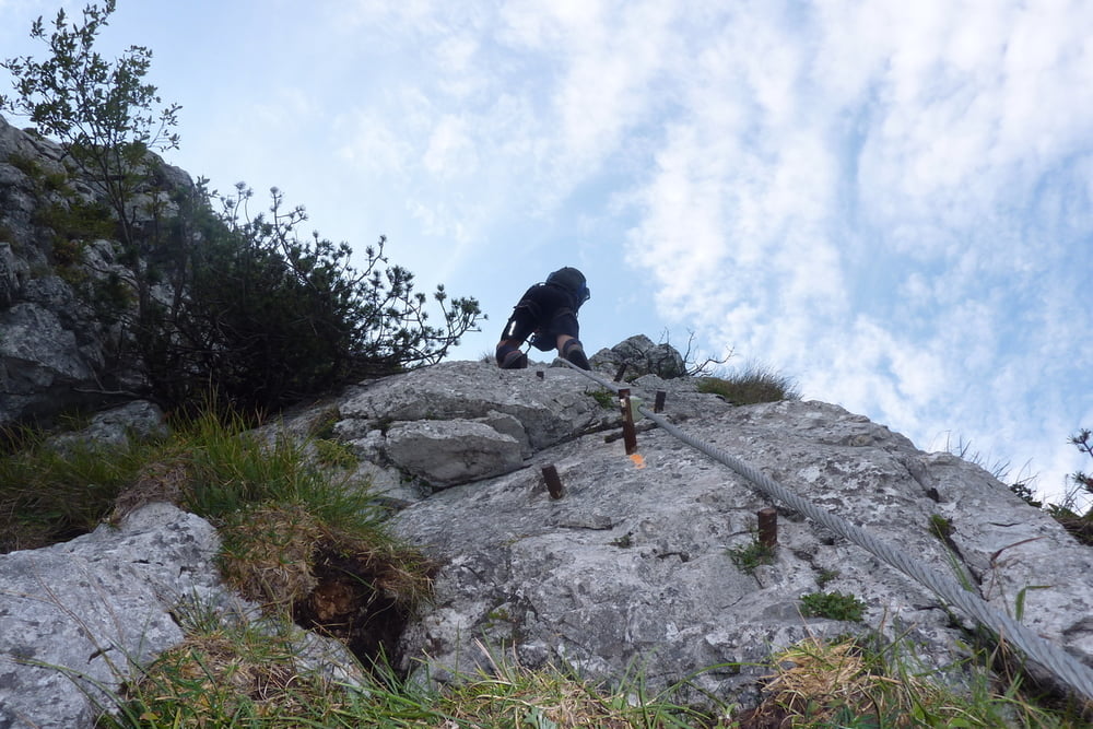
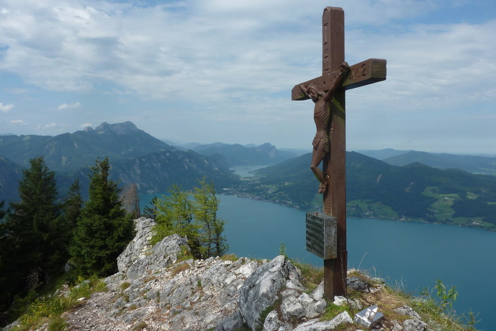
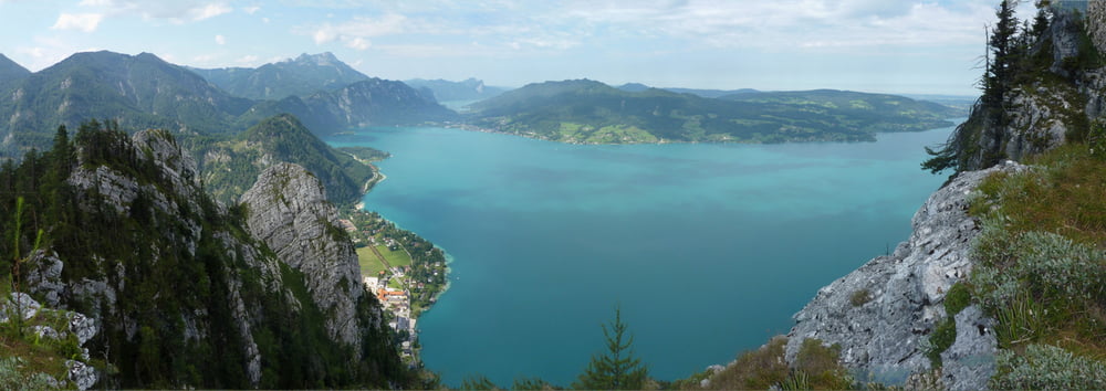
Von Weißenbach am Attersee am Nikolosteig zum Klettersteig Einstieg. Am Klettrersteig auf den Mahdlgupf und von dort am Wanderweg zurück nach Weoßenbach am Attersee.


Tour gallery

Tour map and elevation profile

  • Open Street Map
  • Google
Minimum height 478 m Maximum height 1258 m Detailed view

More about the tour author

f_bergi
Member since 2010

Send private message

Comments

GPS tracks

Trackpoints
  • GPX / Garmin Map Source (gpx) download
  • TCX / Garmin Training Center® (tcx) download
  • CRS / Garmin Training Center® (crs) download
  • Google Earth (kml) download
  • G7ToWin (g7t) download
  • TTQV (trk) download
  • Overlay (ovl) download
  • Fugawi (txt) download
  • Kompass (DAV) Track (tk) download
  • Track data sheet (pdf) download
  • Original file of the author (gpx) download

More about the tour author

f_bergi
Member since 2010

Send private message
Share track
Add to my favorites
Remove from my favorites
Edit tags
My score
Rate
Track: Attersee-Klettersteig
Type: Via ferrata
Distance: 8,4 km
Evaluated on:
Duration:
Day(s)
Hour(s)
Minute(s)
Score: Landscape Fun factor Fitness Technique